IMAGES TAKEN NEAR TO
Farringdon Drive, DONCASTER, DN11 0UT
Introduction
This page details the photographs taken nearby to Farringdon Drive, DN11 0UT by members of the Geograph project.
The Geograph project started in 2005 with the aim of publishing, organising and preserving representative images for every square kilometre of Great Britain, Ireland and the Isle of Man.

There are currently over 7.5m images from over14,400 individuals and you can help contribute to the project by visiting https://www.geograph.org.uk
Image Map (Loading...)


Getting Data...Please wait
Leaflet Map data © OpenStreetMap
Images are licensed for reuse under creativecommons.org/licenses/by-sa/2.0
Notes
- Clicking on the map will re-center to the selected point.
- The higher the marker number, the further away the image location is from the centre of the postcode.
Image Listing (10 Images Found)
Images are licensed for reuse under creativecommons.org/licenses/by-sa/2.0
Image
Details
Distance
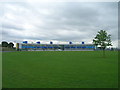
3
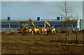
The new All Saints school under construction New Rossington
Image: © Steve Fareham
Taken: 14 Mar 2009
0.10 miles
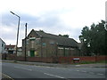
4
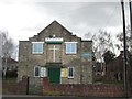
New Life Christian Church, New Rossington
Image: © John Slater
Taken: 23 Mar 2015
0.18 miles
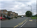
5
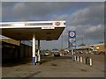
No fuel today
The closed Rossington motor's Rix petrol station opposite Oak Dene.
Image: © Steve Fareham
Taken: 14 Mar 2009
0.19 miles
7
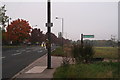
Footpath to Rossington Hall
A grey October evening, and the withered flowers on the telegraph pole indicate an even blacker event.
There is a footbridge over the main railway line from Doncaster.
Image: © Chris
Taken: 21 Oct 2012
0.23 miles
8
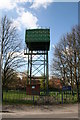
Stripe Road water Tower
On the outskirts of New Rossington
Image: © Richard Croft
Taken: 28 Apr 2006
0.23 miles
9
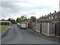
Bruni Way - rear view
This part of New Rossington was built following the Radburn principle whereby vehicle and pedestrian routes in residential areas were segregated. The front of these houses looks like this: Image
Image: © Alan Murray-Rust
Taken: 22 Jul 2007
0.24 miles
10

New Rossington pansies
Alongside Stripe Road.
Image: © Steve Fareham
Taken: 14 Mar 2009
0.24 miles