
IMAGES TAKEN NEAR TO
Chestnut Avenue, DONCASTER, DN11 0DE
Introduction
This page details the photographs taken nearby to Chestnut Avenue, DN11 0DE by members of the Geograph project.
The Geograph project started in 2005 with the aim of publishing, organising and preserving representative images for every square kilometre of Great Britain, Ireland and the Isle of Man.

There are currently over 7.5m images from over14,400 individuals and you can help contribute to the project by visiting https://www.geograph.org.uk
Image Map
Images are licensed for reuse under creativecommons.org/licenses/by-sa/2.0
Notes
- Clicking on the map will re-center to the selected point.
- The higher the marker number, the further away the image location is from the centre of the postcode.
Image Listing (10 Images Found)
Images are licensed for reuse under creativecommons.org/licenses/by-sa/2.0
Image
Details
Distance
1
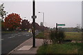
Footpath to Rossington Hall
A grey October evening, and the withered flowers on the telegraph pole indicate an even blacker event.
There is a footbridge over the main railway line from Doncaster.
Image: © Chris
Taken: 21 Oct 2012
0.13 miles
2
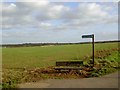
Footpath from Stripe Road New Rossington
The East Coast main rail line is behind the fence in the background.
Image: © Steve Fareham
Taken: 14 Mar 2009
0.13 miles
3
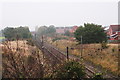
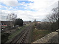
Main line south from Doncaster: from the footbridge
A foggy October evening, but still a good view north up the track to the brick road bridge on the Stripe Road and the new estate on the right.
Image: © Chris
Taken: 21 Oct 2012
0.13 miles
4
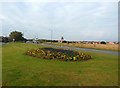
Stripe Road in Rossington
A roadside floral display on the southern outskirts of the village.
Image: © Jonathan Clitheroe
Taken: 14 Oct 2016
0.15 miles
6

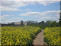
New Rossington pansies
Alongside Stripe Road.
Image: © Steve Fareham
Taken: 14 Mar 2009
0.17 miles
7
Footbridge over the railway at Church Field, Rossington
Image: © John Slater
Taken: 3 Jun 2015
0.19 miles
8
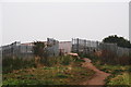
Footbridge over the railway on the Rossington to Rossington footpath
There are two footpaths from Rossington to Rossington Hall. This one also branches off and goes to the Bawtry Road north of Rossington Hall, and passes the lakes.
There is a footbridge over the railway on this path, a lot safer than the crossing over the track half a mile south on the other path (see: Image; Image and Image).
Image: © Chris
Taken: 21 Oct 2012
0.19 miles
9
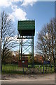
Stripe Road water Tower
On the outskirts of New Rossington
Image: © Richard Croft
Taken: 28 Apr 2006
0.21 miles
10
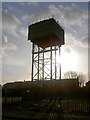
Stripe road water tower
A 'Braithwaite' type steel water tank.
Image: © Steve Fareham
Taken: 14 Mar 2009
0.22 miles