IMAGES TAKEN NEAR TO
Church Walk, DONCASTER, DN10 6JD
Introduction
This page details the photographs taken nearby to Church Walk, DN10 6JD by members of the Geograph project.
The Geograph project started in 2005 with the aim of publishing, organising and preserving representative images for every square kilometre of Great Britain, Ireland and the Isle of Man.

There are currently over 7.5m images from over14,400 individuals and you can help contribute to the project by visiting https://www.geograph.org.uk
Image Map
Images are licensed for reuse under creativecommons.org/licenses/by-sa/2.0
Notes
- Clicking on the map will re-center to the selected point.
- The higher the marker number, the further away the image location is from the centre of the postcode.
Image Listing (119 Images Found)
Images are licensed for reuse under creativecommons.org/licenses/by-sa/2.0
Image
Details
Distance
1
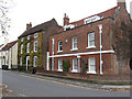
Bawtry - houses at NW end of Church Street
The second from the right of the houses is the listed "Wharf House".
Image: © Dave Bevis
Taken: 27 Oct 2014
0.02 miles
2
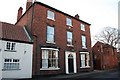
Wharf Street
Handsome Georgian house on Wharf Street
Image: © Richard Croft
Taken: 6 Feb 2007
0.02 miles
3
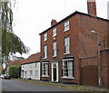
Bawtry - houses on south side of Wharf Street
The red-brick house is No 4 Wharf Street (Leigh House) and is listed (see http://www.britishlistedbuildings.co.uk/en-334751-leigh-house-bawtry- ). For an alternative view, please see Image
Image: © Dave Bevis
Taken: 27 Oct 2014
0.02 miles
4
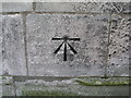
Bawtry, cut bench mark on St Nicholas' church
Cut bench mark with bolt on the wall to the right of the entrance door in the tower. It was used on the London to Doncaster 1GL levelling line of 1848 to 1851. See http://www.bench-marks.org.uk/bm25656 for details.
Image: © Brian Westlake
Taken: 12 Dec 2010
0.03 miles
5
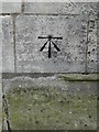
Benchmark - St Nicholas's Church, Bawtry
On the western wall near the modern entrance to the church.
Image: © Neil Theasby
Taken: 14 Mar 2016
0.03 miles
6
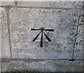
Ordnance Survey 1GL Bolt
This OS Bolt can be found on the NW face of St Nicholas Church. It marks a point 7.7389m above mean sea level.
Image: © Adrian Dust
Taken: 23 May 2016
0.03 miles
7
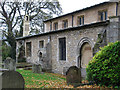
Bawtry - north side of St Nicholas Church - from W
Image: © Dave Bevis
Taken: 27 Oct 2014
0.04 miles
8
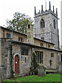
Bawtry - north side of St Nicholas Church - from NE
For more information on this church, please see http://southwellchurches.nottingham.ac.uk/bawtry/hintro.php .
Image: © Dave Bevis
Taken: 27 Oct 2014
0.04 miles
9
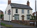
Bawtry - Wharf Farm House
This listed building is on the corner of School Walk with Wharf Street.
Image: © Dave Bevis
Taken: 27 Oct 2014
0.04 miles