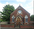
IMAGES TAKEN NEAR TO
Coronation Avenue, DONCASTER, DN10 6DN

Introduction

This page details the photographs taken nearby to Coronation Avenue, DN10 6DN by members of the Geograph project.

The Geograph project started in 2005 with the aim of publishing, organising and preserving representative images for every square kilometre of Great Britain, Ireland and the Isle of Man.

There are currently over 7.5m images from over14,400 individuals and you can help contribute to the project by visiting https://www.geograph.org.uk

Image Map


Images are licensed for reuse under creativecommons.org/licenses/by-sa/2.0
Notes
  • Clicking on the map will re-center to the selected point.
  • The higher the marker number, the further away the image location is from the centre of the postcode.

Image Listing (29 Images Found)

Images are licensed for reuse under creativecommons.org/licenses/by-sa/2.0
  • ...
Image
Details
Distance
1
Bawtry Road, Misson
Image: © JThomas Taken: 28 Jun 2014
0.04 miles
2
House by Top Road, Misson
Image: © Neil Theasby Taken: 14 Mar 2016
0.08 miles
3
Misson mill.
All sorts for sale and open 7 days a week.
Image: © Steve Fareham Taken: 18 Aug 2007
0.08 miles
4
Crop field, Misson
Off Bawtry Road.
Image: © JThomas Taken: 28 Jun 2014
0.09 miles
5
Green off Top Street, Misson
Misson is a compact village and this is one of the few open spaces within the village envelope.
Image: © Jonathan Thacker Taken: 28 Jan 2012
0.10 miles
6
Post box on Back Lane, Misson
Image: © Ian S Taken: 29 Aug 2020
0.11 miles
7
Westfield Villa
A very typical victorian double-front house
Image: © Alan Murray-Rust Taken: 22 Jul 2007
0.16 miles
8
The Chapel, Misson
Image: © John Slater Taken: 26 May 2015
0.16 miles
9
Wesleyan methodist church in Misson
Built to serve a section of the local community in 1897 but now a private residence.
Image: © Neil Theasby Taken: 14 Mar 2016
0.16 miles
10
Former Wesleyan Chapel, Misson
No longer in use as a church.
Image: © Jonathan Thacker Taken: 28 Jan 2012
0.16 miles
  • ...