
IMAGES TAKEN NEAR TO
Prospect Mews, DONCASTER, DN10 4TB
Introduction
This page details the photographs taken nearby to Prospect Mews, DN10 4TB by members of the Geograph project.
The Geograph project started in 2005 with the aim of publishing, organising and preserving representative images for every square kilometre of Great Britain, Ireland and the Isle of Man.

There are currently over 7.5m images from over14,400 individuals and you can help contribute to the project by visiting https://www.geograph.org.uk
Image Map
Images are licensed for reuse under creativecommons.org/licenses/by-sa/2.0
Notes
- Clicking on the map will re-center to the selected point.
- The higher the marker number, the further away the image location is from the centre of the postcode.
Image Listing (65 Images Found)
Images are licensed for reuse under creativecommons.org/licenses/by-sa/2.0
Image
Details
Distance
1
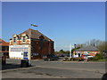
Co-operative store
The new store to the right, which appears to be the only general retail outlet in the village, has replaced the old store, now used as the village Centre. This hosts the Parish Council and other community service such as the Police. The new store also houses the local Post Office.
Image: © Alan Murray-Rust
Taken: 31 Mar 2011
0.12 miles
2
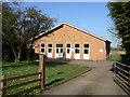
Misterton telephone exchange
A large building for the size of village, it clearly serves quite a large surrounding area.
Image: © Alan Murray-Rust
Taken: 31 Mar 2011
0.12 miles
3
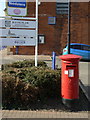
Post Office, Misterton Co-op postbox ref: DN10 229
This is the 'proper' box for the Post Office, not to be confused with Image The additional notice alongside the collection times plate advises that Saturday collections will cease with effect from 14 March 2011.
Image: © Alan Murray-Rust
Taken: 31 Mar 2011
0.12 miles
4
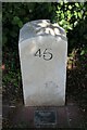
Modern Milestone, Chesterfield Canal
On the towpath, 95m SW of Swallow Bridge, in the parish of Misterton. Mileage relative to Chesterfield.
Inscription: 45
Plaque reads: Edwin and Mary Tomlinson 2005
Nearly There.....
Milestone Society National ID: CHE-45R
Image: © Paul Brunt
Taken: 27 Jan 2016
0.12 miles
5
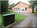
Misterton Telephone Exchange, Notts
Situated in High Street (A161), this redbrick building would have replaced a smaller TE in the same locality possibly during the 1970s. It has the code SLMIS and provides telephone and broadband services to 1,536 residential and 80 non-residential premises in Misterton and the surrounding area including Walkeringham and West Stockwith. A dark green BT cabinet can be seen in the foreground. The numbering range of this TE is (01427) 89xxxx, the (01427) referring to the Gainsborough group of twelve TEs, and its postcode is DN10 4BU.
Image: © David Hillas
Taken: 18 Jul 2019
0.12 miles
6
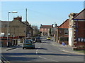
High Street, Misterton
This is the A161. Looking north from the junction with Station Street.
Image: © Alan Murray-Rust
Taken: 31 Mar 2011
0.13 miles
7
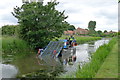
Clearing weed from the Chesterfield Canal
Operated by Fountains on behalf of the Canal and River Trust
Image: © Tim Heaton
Taken: 19 Jun 2015
0.13 miles
8
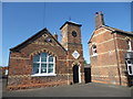
Former Misterton Board School
The plaque over the door says "BOARD SCHOOLS, 1872". My grandmother and her sisters and brothers attended the school in the early 20th century.
Image: © Marathon
Taken: 8 Sep 2019
0.14 miles
9
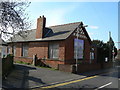
Victoria Institute, Misterton
Opened in June 1897 to commemorate the Diamond Jubilee of Queen Victoria, it is now boarded up and looking forlorn.
Image: © Alan Murray-Rust
Taken: 31 Mar 2011
0.14 miles
10
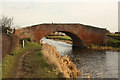
Swallow Bridge
Bridge number 82 over the Chesterfield Canal at Misterton
Image: © Richard Croft
Taken: 16 Feb 2012
0.14 miles