IMAGES TAKEN NEAR TO
Mill Lane, DONCASTER, DN10 4HY
Introduction
This page details the photographs taken nearby to Mill Lane, DN10 4HY by members of the Geograph project.
The Geograph project started in 2005 with the aim of publishing, organising and preserving representative images for every square kilometre of Great Britain, Ireland and the Isle of Man.

There are currently over 7.5m images from over14,400 individuals and you can help contribute to the project by visiting https://www.geograph.org.uk
Image Map (Loading...)


Getting Data...Please wait
Leaflet Map data © OpenStreetMap
Images are licensed for reuse under creativecommons.org/licenses/by-sa/2.0
Notes
- Clicking on the map will re-center to the selected point.
- The higher the marker number, the further away the image location is from the centre of the postcode.
Image Listing (4 Images Found)
Images are licensed for reuse under creativecommons.org/licenses/by-sa/2.0
Image
Details
Distance
1
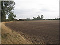
Looking towards Highfield house from Mill Lane
Image: © Jonathan Thacker
Taken: 23 Sep 2011
0.10 miles
2
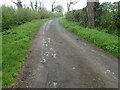
View from Mill Lane, Walkeringham
Mill Lane leads to Highfield House and beyond that to Glebe Farm.
Image: © Marathon
Taken: 21 Apr 2023
0.21 miles
4
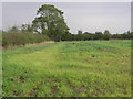
Shed and Tree
This wooden shed is considered permanent enough to be included on the OS map.
Image: © Michael Patterson
Taken: 30 Oct 2006
0.25 miles