
IMAGES TAKEN NEAR TO
Station Road, DONCASTER, DN10 4DG
Introduction
This page details the photographs taken nearby to Station Road, DN10 4DG by members of the Geograph project.
The Geograph project started in 2005 with the aim of publishing, organising and preserving representative images for every square kilometre of Great Britain, Ireland and the Isle of Man.

There are currently over 7.5m images from over14,400 individuals and you can help contribute to the project by visiting https://www.geograph.org.uk
Image Map
Images are licensed for reuse under creativecommons.org/licenses/by-sa/2.0
Notes
- Clicking on the map will re-center to the selected point.
- The higher the marker number, the further away the image location is from the centre of the postcode.
Image Listing (60 Images Found)
Images are licensed for reuse under creativecommons.org/licenses/by-sa/2.0
Image
Details
Distance
1
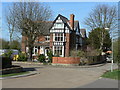
Rose Meadow Centre
Large Victorian house now converted into a residential care home.
Image: © Alan Murray-Rust
Taken: 31 Mar 2011
0.03 miles
2

Misterton Low Lock
Lock no. 64 on the Chesterfield Canal
Image: © Graham Hogg
Taken: 3 Sep 2013
0.05 miles
3
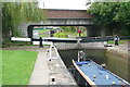
Misterton Low Lock
The lower of the pair has a fall of 6'8". The top lock can be seen beyond the A161 road bridge.
Image: © Graham Horn
Taken: 23 Sep 2012
0.05 miles
4
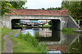
Station Street Bridge No 82a in Misterton
Crossing the Chesterfield Canal and Cuckoo Way next to Misterton Low Lock No 64.
Image: © Mat Fascione
Taken: 28 May 2016
0.06 miles
5

Misterton Low Lock
The lock names along the Chesterfield Canal are conveniently attached to the balance beams. The number shows that this is the 64th lock from Chesterfield. It is also the last before reaching the end of the Canal at West Stockwith Basin.
Image: © Alan Murray-Rust
Taken: 31 Mar 2011
0.06 miles

7
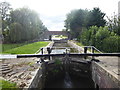
Lock on the Chesterfield Canal at Misterton
The Shell Guide to Nottinghamshire says of Misterton: "It is a strange part of the world. The church stands in the centre of the old village, accompanied by older cottages and farms - some with fine buildings and - Nonconformist chapels. The Chesterfield Canal passes through the village on its way to join the Trent at West Stockwith; there is a delightful walk along the towpath."
The Chesterfield Canal officially opened in 1777. It originally extended 46 miles from the River Trent through Misterton, Worksop and Retford before arriving at its terminus in Chesterfield. The last recorded commercial cargo was in the 1960s. In 1976 the Chesterfield Canal Society, now known as the Chesterfield Canal Trust, was formed.
See https://canalrivertrust.org.uk/enjoy-the-waterways/canal-and-river-network/chesterfield-canal?gclid=Cj0KCQjw_OzrBRDmARIsAAIdQ_IIa5LdoWnWvDGea6K4LDOcZvTZRXRJ_tQORSrl3yFk0xZgUclyN2caAkPpEALw_wcB for full details including a map.
Image: © Marathon
Taken: 7 Sep 2019
0.06 miles
8
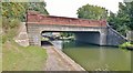
Bridge no 82A on Chesterfield Canal
A relatively recent bridge built to carry a new road alignment.
Image: © Chris Morgan
Taken: 3 Sep 2013
0.06 miles
9
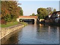
Bridge 82A, Misterton
Carrying Station Street [the A161] over the Chesterfield Canal.
Image: © Christine Johnstone
Taken: 14 Oct 2011
0.06 miles
10
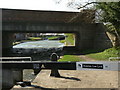
Misterton Low Lock and bridge
The bridge carries the realigned A161 which used to cross at the tail of the lock on what is now Station Road.
Image: © Alan Murray-Rust
Taken: 31 Mar 2011
0.06 miles