IMAGES TAKEN NEAR TO
Ashlea, DONCASTER, DN10 4BG
Introduction
This page details the photographs taken nearby to Ashlea, DN10 4BG by members of the Geograph project.
The Geograph project started in 2005 with the aim of publishing, organising and preserving representative images for every square kilometre of Great Britain, Ireland and the Isle of Man.

There are currently over 7.5m images from over14,400 individuals and you can help contribute to the project by visiting https://www.geograph.org.uk
Image Map
Images are licensed for reuse under creativecommons.org/licenses/by-sa/2.0
Notes
- Clicking on the map will re-center to the selected point.
- The higher the marker number, the further away the image location is from the centre of the postcode.
Image Listing (82 Images Found)
Images are licensed for reuse under creativecommons.org/licenses/by-sa/2.0
Image
Details
Distance
2
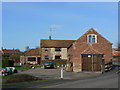
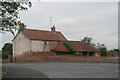
10 Church Street
This appears to have once been a typical village farm (for which I can find no name), now converted simply to dwellings.
Image: © Alan Murray-Rust
Taken: 31 Mar 2011
0.11 miles
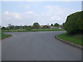
3
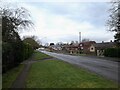
Gringley Road, Misterton (B1403)
Heading north.
Image: © JThomas
Taken: 28 Feb 2015
0.11 miles
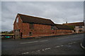
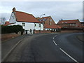
5
House and traditional barn in Church Street
Note the little round windows.
Image: © Chris
Taken: 4 Aug 2013
0.12 miles
9
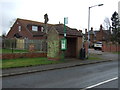
Bus stop and shelter on Gringley Road, Misterton
Image: © JThomas
Taken: 28 Feb 2015
0.15 miles
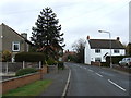
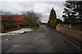
10
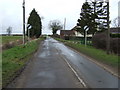
Leaving Misterton
Heading north west on Cattle Road.
Image: © JThomas
Taken: 28 Feb 2015
0.16 miles