IMAGES TAKEN NEAR TO
Carr End, DONCASTER, DN10 4AT
Introduction
This page details the photographs taken nearby to Carr End, DN10 4AT by members of the Geograph project.
The Geograph project started in 2005 with the aim of publishing, organising and preserving representative images for every square kilometre of Great Britain, Ireland and the Isle of Man.

There are currently over 7.5m images from over14,400 individuals and you can help contribute to the project by visiting https://www.geograph.org.uk
Image Map
Images are licensed for reuse under creativecommons.org/licenses/by-sa/2.0
Notes
- Clicking on the map will re-center to the selected point.
- The higher the marker number, the further away the image location is from the centre of the postcode.
Image Listing (36 Images Found)
Images are licensed for reuse under creativecommons.org/licenses/by-sa/2.0
Image
Details
Distance
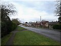
1
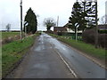
Leaving Misterton
Heading north west on Cattle Road.
Image: © JThomas
Taken: 28 Feb 2015
0.09 miles
3
Gringley Road, Misterton (B1403)
Heading north.
Image: © JThomas
Taken: 28 Feb 2015
0.13 miles
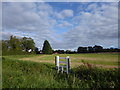
4
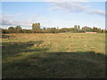
Poorly drained field
Misterton church in the background.
Image: © Jonathan Thacker
Taken: 17 Sep 2011
0.13 miles
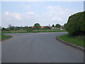
6
Gate on Cattle Road
Cattle Road leads for about two miles from Misterton out on to Misterton Carr, ending at Carr Farm. This is just outside Misterton. I am not sure what the purpose of this gate is though.
Image: © Marathon
Taken: 7 Sep 2019
0.13 miles
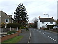
7
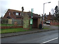
Bus stop and shelter on Gringley Road, Misterton
Image: © JThomas
Taken: 28 Feb 2015
0.13 miles
8
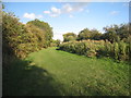
Canal towpath
The Chesterfield canal is hidden behind the vegetation on the right.
Image: © Jonathan Thacker
Taken: 17 Sep 2011
0.18 miles
9
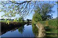
Chesterfield Canal near Misterton
Along the Cuckoo Way.
Image: © steven ruffles
Taken: 26 Oct 2011
0.18 miles
10
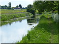
Chesterfield Canal at Misterton
This stretch of the canal is between bridges 80 and 81. On the right is the Cuckoo Way following the towpath of the canal.
Image: © Mat Fascione
Taken: 28 May 2016
0.19 miles