IMAGES TAKEN NEAR TO
Spennithorne, LEYBURN, DL8 5NG
Introduction
This page details the photographs taken nearby to DL8 5NG by members of the Geograph project.
The Geograph project started in 2005 with the aim of publishing, organising and preserving representative images for every square kilometre of Great Britain, Ireland and the Isle of Man.

There are currently over 7.5m images from over14,400 individuals and you can help contribute to the project by visiting https://www.geograph.org.uk
Image Map
Images are licensed for reuse under creativecommons.org/licenses/by-sa/2.0
Notes
- Clicking on the map will re-center to the selected point.
- The higher the marker number, the further away the image location is from the centre of the postcode.
Image Listing (11 Images Found)
Images are licensed for reuse under creativecommons.org/licenses/by-sa/2.0
Image
Details
Distance
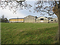
1
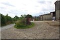
Farm yard beside minor road at Studdah
Image: © Roger Templeman
Taken: 1 Aug 2016
0.04 miles
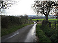
2
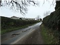
The lane to Barden
Heading north past the barns at Studdah.
Image: © Christine Johnstone
Taken: 8 Mar 2019
0.09 miles
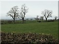
3
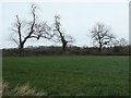
Trees on a field boundary, east of Studdah
In winter the damage to two of them is clear to see.
Image: © Christine Johnstone
Taken: 8 Mar 2019
0.11 miles
4
Close To Studdah
The road from the A684.
Image: © Roger Gilbertson
Taken: 19 Nov 2006
0.12 miles
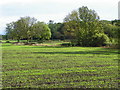
7
Fields with trees, south of Studdah
Looking south-west.
Image: © Christine Johnstone
Taken: 8 Mar 2019
0.14 miles
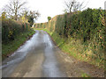
8
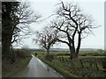
The lane from Barden
Heading south from Studdah, towards the A684.
Image: © Christine Johnstone
Taken: 8 Mar 2019
0.14 miles
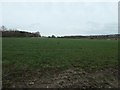
9
Arable field near Harmby
The crop is starting to grow well in the late autumn sunshine.
Image: © Maigheach-gheal
Taken: 6 Oct 2010
0.16 miles
10
Farmland and The Leases woodland
East of Studdah.
Image: © Christine Johnstone
Taken: 8 Mar 2019
0.18 miles