IMAGES TAKEN NEAR TO
East Witton, LEYBURN, DL8 4ST
Introduction
This page details the photographs taken nearby to DL8 4ST by members of the Geograph project.
The Geograph project started in 2005 with the aim of publishing, organising and preserving representative images for every square kilometre of Great Britain, Ireland and the Isle of Man.

There are currently over 7.5m images from over14,400 individuals and you can help contribute to the project by visiting https://www.geograph.org.uk
Image Map (Loading...)


Getting Data...Please wait
Leaflet Map data © OpenStreetMap
Images are licensed for reuse under creativecommons.org/licenses/by-sa/2.0
Notes
- Clicking on the map will re-center to the selected point.
- The higher the marker number, the further away the image location is from the centre of the postcode.
Image Listing (12 Images Found)
Images are licensed for reuse under creativecommons.org/licenses/by-sa/2.0
Image
Details
Distance
1
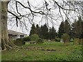
Old churchyard at East Witton
The original churchyard at East Witton is some 350m SSE of the 1809 church. When the Earl of Ailesbury had the new church built in 1809, he also rebuilt much of the village, setting the houses out in a long line either side of a large green. There is no sign of the earlier church in this graveyard, although there is a flat space large enough to accommodate a building.
Image: © Gordon Hatton
Taken: 21 Apr 2007
0.16 miles
2
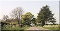
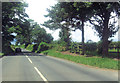
Entering East Witton
The Parish Church of East Witton, seen in the background, is dedicated to St. John the Evangelist. It took three years to build, from 1809 to 1812, at the sole expense of Thomas, Earl of Ailesbury, then Lord of the Manor, to celebrate the 50th year of the reign of King George III.
Image: © Roger Gilbertson
Taken: 20 Nov 2006
0.16 miles
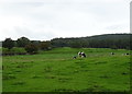
3
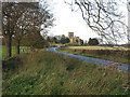
Between East Witton And Abbey Hill
Seen from the A6108 in Coverdale.
Image: © Roger Gilbertson
Taken: 20 Nov 2006
0.16 miles
4
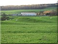
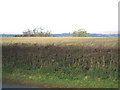
Waterloo Farm
A folded field and a barn beside the A6108.
Image: © Roger Gilbertson
Taken: 20 Nov 2006
0.16 miles
5
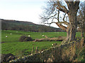
Storm Damage
A fallen tree in a field beside the A6108 between East Witton and Abbey Hill.
Image: © Roger Gilbertson
Taken: 20 Nov 2006
0.16 miles
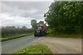
9
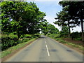
A6108 outside East Witton Mill
The road seen here between Jervaulx and East Witton
Image: © Chris Heaton
Taken: 29 Jun 2013
0.20 miles