IMAGES TAKEN NEAR TO
East Witton Road, LEYBURN, DL8 4PY
Introduction
This page details the photographs taken nearby to East Witton Road, DL8 4PY by members of the Geograph project.
The Geograph project started in 2005 with the aim of publishing, organising and preserving representative images for every square kilometre of Great Britain, Ireland and the Isle of Man.

There are currently over 7.5m images from over14,400 individuals and you can help contribute to the project by visiting https://www.geograph.org.uk
Image Map (Loading...)


Getting Data...Please wait
Leaflet Map data © OpenStreetMap
Images are licensed for reuse under creativecommons.org/licenses/by-sa/2.0
Notes
- Clicking on the map will re-center to the selected point.
- The higher the marker number, the further away the image location is from the centre of the postcode.
Image Listing (14 Images Found)
Images are licensed for reuse under creativecommons.org/licenses/by-sa/2.0
Image
Details
Distance
1
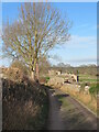
Straight Lane
Farm access lane which is also a public footpath. The converted barn to the right appears to be a holiday cottage.
Image: © Gordon Hatton
Taken: 2 Dec 2021
0.02 miles
2
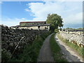
One of several bends on Straight Lane
A lane [and public footpath] running south from the eastern end of Middleham. Shown and named on the earliest large-scale OS map, surveyed in the 1850s.
Image: © Christine Johnstone
Taken: 9 Oct 2022
0.03 miles

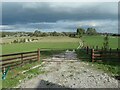
4
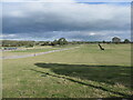
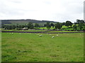
Farmland east of Straight Lane
South-east of Middleham.
Image: © Christine Johnstone
Taken: 9 Oct 2022
0.07 miles
7
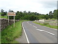
Approaching a bend in the A6108 towards Middleham
The Forbidden Corner referred to on the sign is a unique labyrinth of tunnels, chambers, follies and surprises created within a four acre garden in the heart of Tupgill Park and the Yorkshire Dales.
Image: © JThomas
Taken: 5 Sep 2020
0.12 miles
8
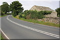
Ruined barn by A6108 bend
There may be OS benchmarks, see http://www.bench-marks.org.uk/bm44761 , on this barn
Image: © Roger Templeman
Taken: 31 Aug 2012
0.12 miles
9
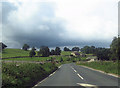
A6108 approaching Chapel Fields
West of Robin Hill
Image: © John Firth
Taken: 30 Jul 2012
0.12 miles
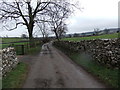
10
Track heading east from Straight Lane
South-east of Middleham.
Image: © Christine Johnstone
Taken: 9 Oct 2022
0.17 miles