IMAGES TAKEN NEAR TO
West Witton, LEYBURN, DL8 4ND

Introduction

This page details the photographs taken nearby to DL8 4ND by members of the Geograph project.

The Geograph project started in 2005 with the aim of publishing, organising and preserving representative images for every square kilometre of Great Britain, Ireland and the Isle of Man.

There are currently over 7.5m images from over14,400 individuals and you can help contribute to the project by visiting https://www.geograph.org.uk

Image Map


Images are licensed for reuse under creativecommons.org/licenses/by-sa/2.0
Notes
  • Clicking on the map will re-center to the selected point.
  • The higher the marker number, the further away the image location is from the centre of the postcode.

Image Listing (43 Images Found)

Images are licensed for reuse under creativecommons.org/licenses/by-sa/2.0
  • ...
Image
Details
Distance
1
Penhill Farm, Middleham High Moor
Image: © JThomas Taken: 5 Sep 2020
0.01 miles
2
Melmerby, Penhill Farm
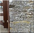
The benchmark is cut into the east facing wall of the farm building on the roadside. The mark is cut into a left hand corner stone.
Image: © Mel Towler Taken: 26 Jul 2022
0.02 miles
3
Melmerby, Penhill Farm
There is a benchmark cut into the east facing wall of the farm building on the roadside. The mark is cut into a left hand corner stone.
Image: © Mel Towler Taken: 26 Jul 2022
0.02 miles
4
Road junction near Penhill Farm
This photograph shows a view of the road junction near Penhill Farm. The road to the left leads to West Witton while that to the right runs along Middleham High Moor. The road from which the photograph was taken leads to Melmerby (behind the photographer). The picture was taken looking in a northerly direction towards Capple Bank Beck.
Image: © Philip Barker Taken: 20 Jun 2010
0.02 miles
5
Penhill Farm
Farm under the shadow of Penhill, with outlooks over the gallops on Middleham High Moor.
Image: © Chris Heaton Taken: 7 Mar 2015
0.02 miles
6
Penhill Farm
The barn has an OS benchmark Image on the angle facing the camera
Image: © Roger Templeman Taken: 26 Sep 2011
0.02 miles
7
Benchmark on barn at Penhill Farm
Ordnance Survey cut mark benchmark described on the Bench Mark Database at http://www.bench-marks.org.uk/bm39663
Image: © Roger Templeman Taken: 26 Sep 2011
0.02 miles
8
Capplebank Plantation
View from Common Lane.
Image: © JThomas Taken: 5 Sep 2020
0.04 miles
9
Grooming The Gallops
A tractor pulls a harrow round the gallops on Middleham High Moor.
Image: © Roger Gilbertson Taken: 21 Nov 2006
0.04 miles
10
Wensleydale
Seen from Middleham High Moor.
Image: © Roger Gilbertson Taken: 21 Nov 2006
0.04 miles
  • ...