IMAGES TAKEN NEAR TO
Thornton Rust, LEYBURN, DL8 3AP
Introduction
This page details the photographs taken nearby to DL8 3AP by members of the Geograph project.
The Geograph project started in 2005 with the aim of publishing, organising and preserving representative images for every square kilometre of Great Britain, Ireland and the Isle of Man.

There are currently over 7.5m images from over14,400 individuals and you can help contribute to the project by visiting https://www.geograph.org.uk
Image Map
Images are licensed for reuse under creativecommons.org/licenses/by-sa/2.0
Notes
- Clicking on the map will re-center to the selected point.
- The higher the marker number, the further away the image location is from the centre of the postcode.
Image Listing (14 Images Found)
Images are licensed for reuse under creativecommons.org/licenses/by-sa/2.0
Image
Details
Distance
1
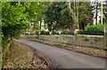
Wall topped with iron railings at Thornton Lodge
Thornton Lodge is a large house just west of Thornton Rust. The substantial wall is mortared as well as having the decorative railings - not an inexpensive barrier!
Image: © Trevor Littlewood
Taken: 5 Jan 2017
0.03 miles
2
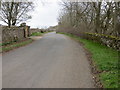
Road above Thornton Scar
Taken from near Thornton Lodge looking north-west.
Image: © Peter Wood
Taken: 1 May 2013
0.05 miles
4
Thornton Scar
Looking north through the trees on Thornton Scar.
Image: © T Eyre
Taken: 11 Sep 2022
0.12 miles
5
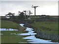
Grey stone and white snow
Remnants of recent snow alongside dry stone walls near Thornton Rust.
Image: © James Allan
Taken: 14 Feb 2013
0.13 miles
6
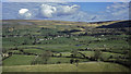
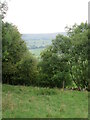
Woodhall seen across Wensleydale from Thornton Rust
Thornton Scar provides a good view across Wensleydale to the north.
Image: © Julian Paren
Taken: Unknown
0.16 miles
7
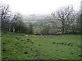
Molehills galore
In a field near Thornton Rust.
Image: © James Allan
Taken: 14 Feb 2013
0.19 miles
8
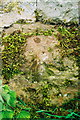
Benchmark on stone at base of barn in Thornton Rust
Ordnance Survey pivot benchmark described on the Bench Mark Database at http://www.bench-marks.org.uk/bm31140
Image: © Roger Templeman
Taken: 26 Jun 2009
0.20 miles
9
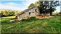
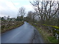
Barn in field on west side of Nipe Lane
There is an Ordnance Survey benchmark Image on a rock at the base of the barn at the junction of its two sections
Image: © Roger Templeman
Taken: 8 Oct 2021
0.20 miles
10
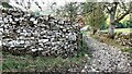
Bend in Nipe Lane at Nipe End
There is an Ordnance Survey benchmark Image on a stone at the base of the wall at its corner in the middle of the image
Image: © Roger Templeman
Taken: 8 Oct 2021
0.21 miles