IMAGES TAKEN NEAR TO
Crestbrooke, NORTHALLERTON, DL7 8YR
Introduction
This page details the photographs taken nearby to Crestbrooke, DL7 8YR by members of the Geograph project.
The Geograph project started in 2005 with the aim of publishing, organising and preserving representative images for every square kilometre of Great Britain, Ireland and the Isle of Man.

There are currently over 7.5m images from over14,400 individuals and you can help contribute to the project by visiting https://www.geograph.org.uk
Image Map
Images are licensed for reuse under creativecommons.org/licenses/by-sa/2.0
Notes
- Clicking on the map will re-center to the selected point.
- The higher the marker number, the further away the image location is from the centre of the postcode.
Image Listing (20 Images Found)
Images are licensed for reuse under creativecommons.org/licenses/by-sa/2.0
Image
Details
Distance
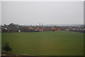
1
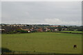
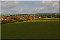
Looking across the Vale of Mowbray
Looking across the housing to the South side of Northallerton towards the lower end of Wensleydale.
Image: © Nick W
Taken: 3 Apr 2003
0.11 miles
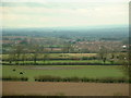
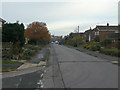
4
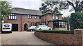
Modern housing at the southern edge of Northallerton
Image: © Christopher Hilton
Taken: 12 Jul 2015
0.12 miles
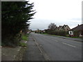
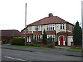
6
Broomfield Avenue, Northallerton
An unassuming suburban street, but there's an interesting past as the left hand houses are built on the site of the old Northallerton Racecourse.
Image: © Alan Murray-Rust
Taken: 6 Nov 2009
0.13 miles
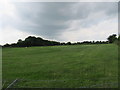
8
#63 Thirsk Road ('Rydal Mount')
Ordnance Survey records indicate that a benchmark levelled at 45.210m above Newlyn Datum was verified in 1972 on a garage on a house at this location. The house and garage have been demolished and the present house built.
Image: © Roger Templeman
Taken: 22 Aug 2021
0.15 miles
9
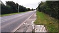
Thirsk Road (A168) heading into Northallerton
Ordnance Survey documents indicate that a benchmark was levelled at 135.154 feet above Liverpool Datum during the 1842-1845 1GL Selby to Newcastle-upon-Tyne survey on top of a milestone (Thirsk 8, Northallerton 1) on the right hand side of the road here. The surveyor's description was 'No. 102. Mark on top of the 8th milepost from Thirsk ; 1.51 ft. above centre of road'. The stone has since disappeared
Image: © Roger Templeman
Taken: 22 Aug 2021
0.15 miles