IMAGES TAKEN NEAR TO
Romanby, NORTHALLERTON, DL7 0PF
Introduction
This page details the photographs taken nearby to DL7 0PF by members of the Geograph project.
The Geograph project started in 2005 with the aim of publishing, organising and preserving representative images for every square kilometre of Great Britain, Ireland and the Isle of Man.

There are currently over 7.5m images from over14,400 individuals and you can help contribute to the project by visiting https://www.geograph.org.uk
Image Map
Images are licensed for reuse under creativecommons.org/licenses/by-sa/2.0
Notes
- Clicking on the map will re-center to the selected point.
- The higher the marker number, the further away the image location is from the centre of the postcode.
Image Listing (8 Images Found)
Images are licensed for reuse under creativecommons.org/licenses/by-sa/2.0
Image
Details
Distance
1

Viewly Bridge
Presumably the bridge takes its name from Viewly Hill Farm which is on the horizon.
Image: © David Rogers
Taken: 23 Feb 2009
0.18 miles
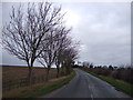
2
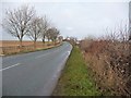
Dolly Lane, near Lark Hall
Heading north over a slight hill.
Image: © Christine Johnstone
Taken: 14 Dec 2010
0.19 miles
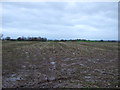
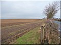
3
Stubble field off Dolly Lane
Above the valley of the Wiske.
Image: © Christine Johnstone
Taken: 14 Dec 2010
0.20 miles
4
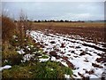
Snow in the shadow of the hedge
Snow lingers only behind the hedge on the east side of Dolly Lane.
Image: © Christine Johnstone
Taken: 14 Dec 2010
0.20 miles
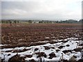
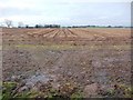
6
Stubble field alongside Dolly Lane
The strip alongside the hedge has not been ploughed.
Image: © Christine Johnstone
Taken: 14 Dec 2010
0.21 miles
7
Stubble field, off Dolly Lane
Last week's snow has melted on this wide open field.
Image: © Christine Johnstone
Taken: 14 Dec 2010
0.24 miles