IMAGES TAKEN NEAR TO
East Cowton, NORTHALLERTON, DL7 0DS

Introduction

This page details the photographs taken nearby to DL7 0DS by members of the Geograph project.

The Geograph project started in 2005 with the aim of publishing, organising and preserving representative images for every square kilometre of Great Britain, Ireland and the Isle of Man.

There are currently over 7.5m images from over14,400 individuals and you can help contribute to the project by visiting https://www.geograph.org.uk

Image Map


Images are licensed for reuse under creativecommons.org/licenses/by-sa/2.0
Notes
  • Clicking on the map will re-center to the selected point.
  • The higher the marker number, the further away the image location is from the centre of the postcode.

Image Listing (7 Images Found)

Images are licensed for reuse under creativecommons.org/licenses/by-sa/2.0
Image
Details
Distance
1
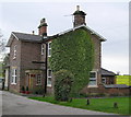
Station Master's House : Cowton Station
One of a number of railway buildings here.
Image: © Hugh Mortimer Taken: 2 May 2006
0.01 miles
2
Road descending to below the railway
Image: © Mick Garratt Taken: 7 Aug 2019
0.02 miles
3
Cowton Station
Half a mile from East Cowton, was once a North Eastern Railway main line station. Now a private house.
Image: © Hugh Mortimer Taken: 2 May 2006
0.04 miles
4
Former station at Cowton, 1988
View NE, towards Darlington etc.: NER East Coast Main Line, Northallerton - Darlington section. The station was closed to passengers on 15/9/58, to goods 1/6/64, but of course the line (recently electrified) remains as active as ever. The station house seems to be in process of renovation as a private house. (My BMW 520 is prominent).
Image: © Ben Brooksbank Taken: 10 Jun 1988
0.05 miles
5
Copse and farmland, East Cowton
This small circular copse stands in arable farmland to the east of the village.
Image: © Andrew Smith Taken: 30 Nov 2011
0.12 miles
6
Farmland near East Cowton
Image: © JThomas Taken: 31 Mar 2012
0.17 miles
7
Stream near East Cowton
Image: © Mick Garratt Taken: 7 Aug 2019
0.24 miles