IMAGES TAKEN NEAR TO
Pierremont Gardens, DARLINGTON, DL3 9PE

Introduction

This page details the photographs taken nearby to Pierremont Gardens, DL3 9PE by members of the Geograph project.

The Geograph project started in 2005 with the aim of publishing, organising and preserving representative images for every square kilometre of Great Britain, Ireland and the Isle of Man.

There are currently over 7.5m images from over14,400 individuals and you can help contribute to the project by visiting https://www.geograph.org.uk

Image Map


Images are licensed for reuse under creativecommons.org/licenses/by-sa/2.0
Notes
  • Clicking on the map will re-center to the selected point.
  • The higher the marker number, the further away the image location is from the centre of the postcode.

Image Listing (16 Images Found)

Images are licensed for reuse under creativecommons.org/licenses/by-sa/2.0
Image
Details
Distance
1
Pierremont Gardens
Heading west.
Image: © JThomas Taken: 17 Nov 2012
0.04 miles
2
Houses on Pierremont Gardens
Image: © JThomas Taken: 17 Nov 2012
0.04 miles
3
Tower Road, Darlington
Image: © JThomas Taken: 17 Nov 2012
0.10 miles
4
Old Milepost in Pierremont Crescent, Darlington
Cast iron post by the UC road, in parish of DARLINGTON (DARLINGTON District), Pierremont Crescent, by No. 27, in pavement, back to low wall, on East side of road. Darlington GPO iron post, erected by General Post Office in the 19th century, probably to assist with telegram delivery. Inscription reads:- 1 MILE GPO Milestone Society National ID: DU_DAGPOf.
Image: © Milestone Society Taken: 15 Mar 2017
0.11 miles
5
Boundary wall of #104 Woodland Road
There is an OS benchmark Image on the gatepier at the right hand side of the entrance
Image: © Roger Templeman Taken: 6 Sep 2016
0.14 miles
6
Entrance to Woodlands Court, off Milbank Road
Image: © Roger Templeman Taken: 6 Sep 2016
0.14 miles
7
Benchmark on gatepier of #104 Woodland Road
Ordnance Survey cut mark benchmark described on the Bench Mark Database at http://www.bench-marks.org.uk/bm78669
Image: © Roger Templeman Taken: 6 Sep 2016
0.15 miles
8
Benchmark on Millbank Road wall
Ordnance Survey cut mark benchmark described on the Bench Mark Database at http://www.bench-marks.org.uk/bm78668
Image: © Roger Templeman Taken: 6 Sep 2016
0.18 miles
9
Houses at junction of Millbank Road and Cleveland Avenue
There is an OS benchmark Image on the curved bridge wall bounding the nearest house
Image: © Roger Templeman Taken: 6 Sep 2016
0.18 miles
10
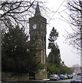
Pierremont clock tower : Tower Road
1873 Alfred Waterhouse designed Tower and buildings, for Henry Pease. See http://www.britishlistedbuildings.co.uk/en-110722-the-clock-tower-
Image: © Hugh Mortimer Taken: 14 Mar 2006
0.18 miles