
IMAGES TAKEN NEAR TO
Romanby Drive, DARLINGTON, DL3 8EJ
Introduction
This page details the photographs taken nearby to Romanby Drive, DL3 8EJ by members of the Geograph project.
The Geograph project started in 2005 with the aim of publishing, organising and preserving representative images for every square kilometre of Great Britain, Ireland and the Isle of Man.

There are currently over 7.5m images from over14,400 individuals and you can help contribute to the project by visiting https://www.geograph.org.uk
Image Map
Images are licensed for reuse under creativecommons.org/licenses/by-sa/2.0
Notes
- Clicking on the map will re-center to the selected point.
- The higher the marker number, the further away the image location is from the centre of the postcode.
Image Listing (14 Images Found)
Images are licensed for reuse under creativecommons.org/licenses/by-sa/2.0
Image
Details
Distance
3
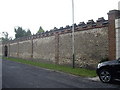
Entry to a walled garden
From Blackwell, Darlington.
Image: © Stanley Howe
Taken: 14 Aug 2010
0.14 miles
4
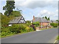
Houses on Blackwell
A suburb of Darlington near the River Tees.
Image: © Oliver Dixon
Taken: 10 Aug 2017
0.14 miles
5
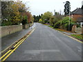
A Road called Blackwell
This rather tidy suburban thoroughfare on the outskirts of Darlington has been adopted by the Teesdale Way on its journey towards the North Sea.
Image: © Chris Heaton
Taken: 4 Nov 2009
0.15 miles
6
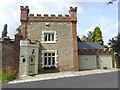
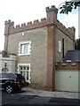
Castellated house on Blackwell
The small blue plaque indicates that this house is the recipient of the Mayor's Design Award 1990.
Image: © Oliver Dixon
Taken: 10 Aug 2017
0.15 miles
8
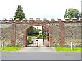
Gateway to Sheraton Park
A large house on Blackwell.
Image: © Oliver Dixon
Taken: 10 Aug 2017
0.17 miles
10
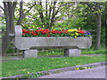
Drinking Fountain.
A trough at Blands Corner roundabout. Inscribed 'Drinking Fountain and Cattle Trough Association, 70 Victoria Street, SW' it was moved to a less vulnerable position on the grass verge when the southern bypass was built.
Image: © Hugh Mortimer
Taken: 4 May 2006
0.21 miles