IMAGES TAKEN NEAR TO
Holyrood Avenue, DARLINGTON, DL3 8AZ
Introduction
This page details the photographs taken nearby to Holyrood Avenue, DL3 8AZ by members of the Geograph project.
The Geograph project started in 2005 with the aim of publishing, organising and preserving representative images for every square kilometre of Great Britain, Ireland and the Isle of Man.

There are currently over 7.5m images from over14,400 individuals and you can help contribute to the project by visiting https://www.geograph.org.uk
Image Map
Images are licensed for reuse under creativecommons.org/licenses/by-sa/2.0
Notes
- Clicking on the map will re-center to the selected point.
- The higher the marker number, the further away the image location is from the centre of the postcode.
Image Listing (14 Images Found)
Images are licensed for reuse under creativecommons.org/licenses/by-sa/2.0
Image
Details
Distance
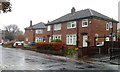
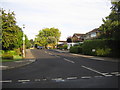
1
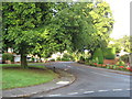
Holyrood Avenue Darlington
In the west end of the town
Image: © Peter Robinson
Taken: 25 Aug 2009
0.02 miles
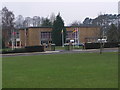
2
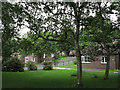
Grassed area with trees
The houses of Hanover Close are seen beyond the trees which are on Edinburgh Drive in the Hummersknott district of Darlington.
Image: © Trevor Littlewood
Taken: 2 Jun 2014
0.07 miles
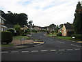
3
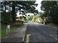
Edinburgh Drive, Darlington
In the west end of the town
Image: © Peter Robinson
Taken: 25 Aug 2009
0.08 miles
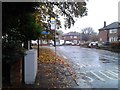
7
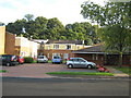
Dalkeith House
Sheltered housing in Tees Grange Avenue, Darlington.
Image: © Peter Robinson
Taken: 25 Aug 2009
0.17 miles
8
Dalkeith Close Darlington
Off Tees Grange Avenue in the west end of the town
Image: © Peter Robinson
Taken: 25 Aug 2009
0.18 miles
9
Tees Grange Avenue Darlington
In the west end of the town
Image: © Peter Robinson
Taken: 25 Aug 2009
0.18 miles
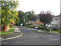
10
West View Darlington
Off Tees Grange Avenue in the west end of the town
Image: © Peter Robinson
Taken: 25 Aug 2009
0.18 miles