
IMAGES TAKEN NEAR TO
Westcliffe Court, DARLINGTON, DL3 7UH
Introduction
This page details the photographs taken nearby to Westcliffe Court, DL3 7UH by members of the Geograph project.
The Geograph project started in 2005 with the aim of publishing, organising and preserving representative images for every square kilometre of Great Britain, Ireland and the Isle of Man.

There are currently over 7.5m images from over14,400 individuals and you can help contribute to the project by visiting https://www.geograph.org.uk
Image Map
Images are licensed for reuse under creativecommons.org/licenses/by-sa/2.0
Notes
- Clicking on the map will re-center to the selected point.
- The higher the marker number, the further away the image location is from the centre of the postcode.
Image Listing (42 Images Found)
Images are licensed for reuse under creativecommons.org/licenses/by-sa/2.0
Image
Details
Distance
1
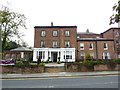
Bannatyne Hotel
An early 19th century villa on Conscliffe Road, formerly the home of railway pioneer Joseph Pease http://en.wikipedia.org/wiki/Joseph_Pease_(railway_pioneer) until his death in 1872. Afterwards Southend Roman Catholic School and The Grange Hotel, now Bannatyne Hotel http://www.bannatyne.co.uk/hotel/darlington/
Image: © Richard Croft
Taken: 21 Sep 2011
0.03 miles
2
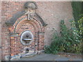
Drinking Fountain Darlington
In Coniscliffe Road donated to the town in 1866 by Joseph Pease
Image: © Peter Robinson
Taken: 23 Sep 2009
0.04 miles
3
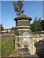
Darlington Coat of Arms
With the inscription Floreat Industria (may industry flourish) on a stone pillar at the north eastern end of Southend Avenue.
Image: © Peter Robinson
Taken: 1 Oct 2009
0.08 miles
4
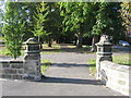
Urban walk Darlington
Entrance to a tree lined walk between Southend Avenue and Grange Road
Image: © Peter Robinson
Taken: 1 Oct 2009
0.08 miles
5
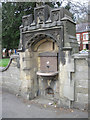
1866 Drinking Fountain, Grange Road
One of a series donated by Joseph Pease in 1866
Image: © Chris Twigg
Taken: 16 Apr 2012
0.09 miles
6
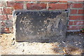
Benchmark on gatepier at former entrance to St Augustine's Centre
Ordnance Survey cut mark benchmark described on the Bench Mark Database at http://www.bench-marks.org.uk/bm78462
Image: © Roger Templeman
Taken: 26 Aug 2016
0.09 miles
7
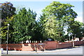
Boundary wall of St Augustine's Parish Centre, Coniscliffe Road
There is an OS benchmark Image at the base of the left hand gatepier of the bricked-up gateway at the junction of Coniscliffe Road and Larchfield Street
Image: © Roger Templeman
Taken: 26 Aug 2016
0.10 miles
8
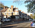
Terraced property on Southend Avenue
These large terraced properties on the south western fringe of the town centre mark the beginnings of the leafy suburbs on this side of the town. They are not shown on the 1899 map, but are on that of 1914. Southend Avenue appears to have been named after a villa that once stood behind these houses, and not after a brash resort in Essex.
Image: © Gordon Hatton
Taken: 4 Nov 2017
0.11 miles
9
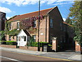
Hogarth Court Darlington
Darlington Housing Association flats for the elderly and disabled
Image: © Peter Robinson
Taken: 23 Sep 2009
0.12 miles
10
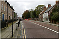
Clervaux Bakery and Cafe, Coniscliffe Road
Image: © Mark Anderson
Taken: 17 Oct 2020
0.12 miles