IMAGES TAKEN NEAR TO
Greenside Court, DARLINGTON, DL2 2HS

Introduction

This page details the photographs taken nearby to Greenside Court, DL2 2HS by members of the Geograph project.

The Geograph project started in 2005 with the aim of publishing, organising and preserving representative images for every square kilometre of Great Britain, Ireland and the Isle of Man.

There are currently over 7.5m images from over14,400 individuals and you can help contribute to the project by visiting https://www.geograph.org.uk

Image Map


Images are licensed for reuse under creativecommons.org/licenses/by-sa/2.0
Notes
  • Clicking on the map will re-center to the selected point.
  • The higher the marker number, the further away the image location is from the centre of the postcode.

Image Listing (29 Images Found)

Images are licensed for reuse under creativecommons.org/licenses/by-sa/2.0
  • ...
Image
Details
Distance
1
Houses by the green [2]
An attractive row of cottages with gothic/tudor fronts of circa 1840.
Image: © Gordon Hatton Taken: 27 Nov 2009
0.05 miles
2
Hurworth Green
Looking across the green to a row of 18th and 19th century houses along the north side.
Image: © Gordon Hatton Taken: 27 Nov 2009
0.07 miles
3
Bus Shelter, Hurworth-on-Tees
One of a dwindling number of wooden bus shelters in the Darlington area
Image: © mark harrington Taken: 8 Aug 2005
0.08 miles
4
Hurworth village looking East
This is the other end of the village from Dave Dunford's Image photo. Virtually in the centre of the image is George V 1911 memorial and to its right is the Church School on Blind Lane and to its left just behind that street light is Mick Harrington's wooden bus shelter Image Just out of shot to the left where the parked cars are is the village supermarket - just a small one but not the old fashioned shop type.
Image: © Nick W Taken: 29 Oct 2007
0.08 miles
5
Houses by the green [1]
A mix of styles and periods along the north side of Hurworth green.
Image: © Gordon Hatton Taken: 27 Nov 2009
0.08 miles
6
Hurworth-on-Tees, The Green
In 1665, the Great Plague almost wiped out the village population of 750 leaving only around 75 survivors. The plague struck many other nearby villages including Birkby and South Cowton. Three dips in the village green mark the site where as many as 1,500 people were buried in massive lime pits. According to old records, bodies from other nearby villages were ferried across the River Tees for burial in Hurworth. (source Wikipedia)
Image: © Colin Park Taken: 8 Aug 2022
0.08 miles
7
Hurworth, Old School House
Former Victorian school and house at the west end of the village green.
Image: © Gordon Hatton Taken: 27 Nov 2009
0.09 miles
8
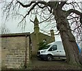
Hurworth, Church School
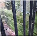
There is a large pivot benchmark cut into the east face of a supporting buttress. The cutmark can be seen by peering through the barred gate and to the right.
Image: © Mel Towler Taken: 22 Jan 2023
0.09 miles
9
Hurworth, Church School
The large pivot benchmark is cut into the east face of a supporting buttress. The locked gates make it difficult to see but it is in very good condition.
Image: © Mel Towler Taken: 22 Jan 2023
0.09 miles
10
Village shop and ornamental fountain
The stone fountain, with decorated urn on the top, was erected to commemorate the accession of King George V in 1911 and had a drinking fountain and horse trough. The local Spar shop is just across the road.
Image: © Gordon Hatton Taken: 27 Nov 2009
0.09 miles
  • ...