IMAGES TAKEN NEAR TO
Fleming Way, CROOK, DL15 0GS
Introduction
This page details the photographs taken nearby to Fleming Way, DL15 0GS by members of the Geograph project.
The Geograph project started in 2005 with the aim of publishing, organising and preserving representative images for every square kilometre of Great Britain, Ireland and the Isle of Man.

There are currently over 7.5m images from over14,400 individuals and you can help contribute to the project by visiting https://www.geograph.org.uk
Image Map
Images are licensed for reuse under creativecommons.org/licenses/by-sa/2.0
Notes
- Clicking on the map will re-center to the selected point.
- The higher the marker number, the further away the image location is from the centre of the postcode.
Image Listing (15 Images Found)
Images are licensed for reuse under creativecommons.org/licenses/by-sa/2.0
Image
Details
Distance
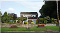
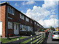
2
House on the A690, Willington
At the junction with Stony Bank.
Image: © JThomas
Taken: 27 Aug 2018
0.09 miles
3
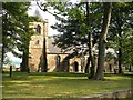
St Stephens Church hiding in the trees
Image: © Alex McGregor
Taken: 7 Sep 2010
0.09 miles
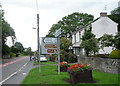
5
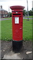
Elizabeth II postbox on the A690, Willington
Postbox No. DL15 205.
See Image] for context.
Image: © JThomas
Taken: 27 Aug 2018
0.10 miles
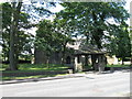
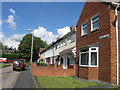
6
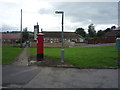
Houses on the A690, Willington
Showing position of postbox No. DL15 205.
See Image] for postbox.
Image: © JThomas
Taken: 27 Aug 2018
0.11 miles
9
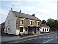
The Black Horse, Willington
On Low Willington.
Image: © JThomas
Taken: 27 Aug 2018
0.17 miles