
IMAGES TAKEN NEAR TO
Evenwood Gate, BISHOP AUCKLAND, DL14 9NS
Introduction
This page details the photographs taken nearby to DL14 9NS by members of the Geograph project.
The Geograph project started in 2005 with the aim of publishing, organising and preserving representative images for every square kilometre of Great Britain, Ireland and the Isle of Man.

There are currently over 7.5m images from over14,400 individuals and you can help contribute to the project by visiting https://www.geograph.org.uk
Image Map
Images are licensed for reuse under creativecommons.org/licenses/by-sa/2.0
Notes
- Clicking on the map will re-center to the selected point.
- The higher the marker number, the further away the image location is from the centre of the postcode.
Image Listing (16 Images Found)
Images are licensed for reuse under creativecommons.org/licenses/by-sa/2.0
Image
Details
Distance
1
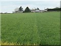
Hilton Moor Farm, from the east
The farm is at a 172 metre spot height on Moor Lane.
Image: © Christine Johnstone
Taken: 12 Apr 2019
0.01 miles
2

Hilton Moor Farm, near West Auckland
Hilton Moor Farm set in rolling pasture. Looking north.
Image: © Oliver Dixon
Taken: 12 Dec 2005
0.04 miles
3

The yellow line splits on Hilton Moor
This is a public footpath heading south to Hilton. It curves left [east] at the 'junction'.
Image: © Christine Johnstone
Taken: 12 Apr 2019
0.12 miles
4

Public footpath heading south to Hilton
A yellow line crossing Hilton Moor.
Image: © Christine Johnstone
Taken: 12 Apr 2019
0.12 miles
5
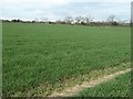
Hilton Moor farmland
Between the lane and the footpath that both head south to Hilton.
Image: © Christine Johnstone
Taken: 12 Apr 2019
0.15 miles
6

Public footpath heading north from Hilton
Occupying one tractor tyre track. But why is it so yellow?
Image: © Christine Johnstone
Taken: 12 Apr 2019
0.15 miles
7

Public footpath heading north from Hilton, at Hilton Moor
There used to be a field boundary from the foreground to the distant clump of trees.
Image: © Christine Johnstone
Taken: 12 Apr 2019
0.16 miles
8

Western end of Hummerbeck Lane, West Auckland
Recently, Hummerbeck Lane has been designated as part of the Walney to Wear Cycle Route (National Cycle Network, Regional Route 20), and affords a traffic-free but rather muddy route for cyclists between Bishop Auckland and Barnard Castle. Looking north-east. At this point, the lane emerges onto Hilton Moor Lane.
Image: © Oliver Dixon
Taken: 12 Dec 2005
0.17 miles
9

Hummerbeck Lane
From the Hilton Moor end. In my youth it was known as 'Green Lonnan' and further north it was the gathering point for 'pitch and toss' gamblers on the Sabbath.
Image: © Stanley Howe
Taken: 7 Apr 2006
0.17 miles
10

View of Brusselton Hill from Hilton Moor
The A68 from Corbridge to Darlington passes up Bildershaw Bank this side of the summit.
Image: © Stanley Howe
Taken: 7 Apr 2006
0.19 miles