IMAGES TAKEN NEAR TO
Durham Road, BISHOP AUCKLAND, DL14 7HY
Introduction
This page details the photographs taken nearby to Durham Road, DL14 7HY by members of the Geograph project.
The Geograph project started in 2005 with the aim of publishing, organising and preserving representative images for every square kilometre of Great Britain, Ireland and the Isle of Man.

There are currently over 7.5m images from over14,400 individuals and you can help contribute to the project by visiting https://www.geograph.org.uk
Image Map
Images are licensed for reuse under creativecommons.org/licenses/by-sa/2.0
Notes
- Clicking on the map will re-center to the selected point.
- The higher the marker number, the further away the image location is from the centre of the postcode.
Image Listing (96 Images Found)
Images are licensed for reuse under creativecommons.org/licenses/by-sa/2.0
Image
Details
Distance
1
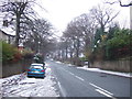
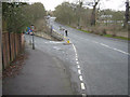
Durham Road, Bishop Auckland
Heading north west.
Image: © JThomas
Taken: 13 Dec 2015
0.03 miles
2
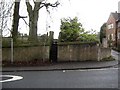
Wall stile for footpath from Durham Road Bishop Auckland to New Coundon
Image: © Peter Robinson
Taken: 13 Mar 2011
0.03 miles
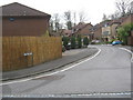
3
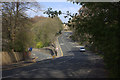
Junction of Durham Road and Gib Chare, Bishop Auckland
Image: © Robert Eva
Taken: 21 Apr 2019
0.07 miles
4
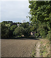
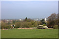
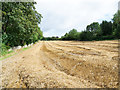
Path at field edge on north side of Durham Road
The path descends alongside a drilled field with the parkland of Auckland Castle off to the right.
The small town of Bishop Auckland lies beyond the trees, its only high-rise building seen above them.
Image: © Trevor Littlewood
Taken: 24 Sep 2021
0.09 miles
5
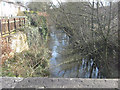
The River Gaunless flowing towards Gib Chare Bridge Bishop Auckland
Image: © Peter Robinson
Taken: 13 Mar 2011
0.09 miles
6
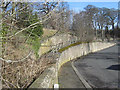
Raised footway from Gib Chare to Durham Road, Bishop Auckland
Image: © Peter Robinson
Taken: 13 Mar 2011
0.10 miles
7
Bishop Auckland from Durham Road
Looking towards the Market Place. Auckland Tower can be seen on the right.
Image: © Robert Eva
Taken: 21 Apr 2019
0.10 miles
8
Junction of Gib Chare, descending to the left, off Durham Road, Bishop Auckland
Image: © Peter Robinson
Taken: 13 Mar 2011
0.11 miles
9
Stubble field in Bishop Auckland
The field, unusually close to a town centre, lies between the parkland of Auckland Castle beyond the wall to the left, and the gardens of large detached houses to the right. A public footpath follows the wall line.
Image: © Trevor Littlewood
Taken: 20 Aug 2019
0.11 miles
10
The Dell Bishop Auckland
Residential area near to the River Gaunless, seen from Durham Chare
Image: © Peter Robinson
Taken: 9 Apr 2010
0.12 miles