1
Prince's Street meets Gibbon Street
Looking across the junction of Prince's Street with Gibbon Street to the west of the town centre in Bishop Auckland.
Image: © DS Pugh
Taken: 9 Sep 2023
0.09 miles
2
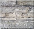
Ordnance Survey Cut Mark
This OS cut mark can be found on the south face of St Peter's Church. It marks a point 99.468m above mean sea level.
Image: © Adrian Dust
Taken: 18 Sep 2018
0.10 miles
3
Bishop Auckland - St Peter's Church
On Princes Street. For an alternative view, please see
Image
Image: © Dave Bevis
Taken: 21 Sep 2013
0.10 miles
4
Gibbon Street at the junction with Prince's Street
Looking towards the junction with Vickers Street ahead.
Image: © DS Pugh
Taken: 9 Sep 2023
0.10 miles
5
Princes Street, Bishop Auckland
Princes Street is in north-western Bishop Auckland. The church beyond the terrace is St. Peter's, described in the Pevsner guide for County Durham as having a copper 'fleche' which clearly refers to the covering of the spire.
Image: © Trevor Littlewood
Taken: 27 Sep 2011
0.10 miles
6
Wesley Methodist Church, Bishop Auckland
On Newgate Street.
Image: © JThomas
Taken: 13 Dec 2015
0.11 miles
7
Wesley Methodist Church, Bishop Auckland
This church is on Newgate Street, in the town centre. It was opened in 1914 to replace an earlier chapel on the same site.
Image: © Robert Graham
Taken: 23 Oct 2013
0.11 miles
8
Roundabout on Princes Street, Bishop Auckland
Looking west on a wet autumn morning. The A689 is to the right. The tower of St Peter's Church is visible in the distance.
Image: © Robert Graham
Taken: 23 Oct 2013
0.11 miles
9
Former Church in Bishop Auckland
Now the Four Clocks Centre. Viewed from Morrisons car park.
Image: © DS Pugh
Taken: 17 Feb 2024
0.12 miles
10
Wesley Methodist Church, Bishop Auckland
Grade II listed. Listing number 1196578. Wesleyan Methodist Church with railings attached. 1908-1914. By Gordon & Gunter. Builder Thomas Hilton. Foundation stone laid 1912.
Image: © Andrew Abbott
Taken: 4 Jan 2020
0.12 miles


