IMAGES TAKEN NEAR TO
The Loop Gill, BISHOP AUCKLAND, DL13 5JW
Introduction
This page details the photographs taken nearby to The Loop Gill, DL13 5JW by members of the Geograph project.
The Geograph project started in 2005 with the aim of publishing, organising and preserving representative images for every square kilometre of Great Britain, Ireland and the Isle of Man.

There are currently over 7.5m images from over14,400 individuals and you can help contribute to the project by visiting https://www.geograph.org.uk
Image Map
Images are licensed for reuse under creativecommons.org/licenses/by-sa/2.0
Notes
- Clicking on the map will re-center to the selected point.
- The higher the marker number, the further away the image location is from the centre of the postcode.
Image Listing (6 Images Found)
Images are licensed for reuse under creativecommons.org/licenses/by-sa/2.0
Image
Details
Distance
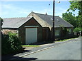
2
Houses at South Side
Near Butterknowle village.
Image: © Oliver Dixon
Taken: 29 Jun 2018
0.14 miles
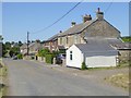
4
2 pm in South Side
Attractive clock with gargoyles either side seen in this hamlet in County Durham
Image: © Peter Robinson
Taken: 2 Aug 2009
0.20 miles