IMAGES TAKEN NEAR TO
High Street, BISHOP AUCKLAND, DL13 4DH

Introduction

This page details the photographs taken nearby to High Street, DL13 4DH by members of the Geograph project.

The Geograph project started in 2005 with the aim of publishing, organising and preserving representative images for every square kilometre of Great Britain, Ireland and the Isle of Man.

There are currently over 7.5m images from over14,400 individuals and you can help contribute to the project by visiting https://www.geograph.org.uk

Image Map


Images are licensed for reuse under creativecommons.org/licenses/by-sa/2.0
Notes
  • Clicking on the map will re-center to the selected point.
  • The higher the marker number, the further away the image location is from the centre of the postcode.

Image Listing (67 Images Found)

Images are licensed for reuse under creativecommons.org/licenses/by-sa/2.0
  • ...
Image
Details
Distance
1
High Street, Tow Law
Looking north up the street.
Image: © Robert Graham Taken: 15 Aug 2012
0.00 miles
2
High Street, Tow Law
Image: © Alex McGregor Taken: 23 Apr 2010
0.01 miles
3
High Street, Tow Law
Tow Law's High Street is also the A68 Darlington - Edinburgh road.
Image: © Stephen McKay Taken: 15 Aug 2008
0.02 miles
4
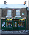
Tow Law Pharmacy
This is Tow Law pharmacy at 24 High Street (A68) with its traditional shopfront. Note the stained glass coloured bottles directly beneath the shop sign. The Pharmacist seems to know everybody in the town by sight and name; I certainly never have to say my name to collect prescriptions. Like most of the Tow Law establishments, you have to drive nearly five miles to Crook to find the next one, or use the scarce bus service.
Image: © Ian Porter Taken: 6 Feb 2009
0.02 miles
5
Main street in Tow Law
This street carries heavy traffic from the A68
Image: © Oliver Dixon Taken: 3 Apr 2006
0.02 miles
6
The Old Station Inn, Tow Law
Tow Law is a town developed for iron smelting and finishing, exploiting local coal and iron ore deposits. The name, however, is olde English meaning hill look-out. The Old Station Inn, on the corner of High Street and Station Street, is a reminder of the town's railway station, closed to passengers in 1956.
Image: © Stephen McKay Taken: 15 Aug 2008
0.02 miles
7
High Street
High Street A68 heading North at Tow Law
Image: © Shaun Ferguson Taken: 1 Sep 2018
0.03 miles
8
Post Office, Tow Law
Looking south down the High Street, the A68.
Image: © Robert Graham Taken: 15 Aug 2012
0.03 miles
9
The Old Station Inn, Tow Law
Image: © Ian S Taken: 24 Oct 2011
0.04 miles
10
High Street, Tow Law
Image: © Alex McGregor Taken: 23 Apr 2010
0.04 miles
  • ...