1
Village emblem in Bowes
This interesting artifact stands by the cross roads at the eastern end of the Street in Bowes village. A villager was unable to enlighten me as to its significance.
Image: © Oliver Dixon
Taken: 18 Jan 2017
0.04 miles
2
Bowes houses [3]
Croft House and Sunny Croft, The Street, are a pair of houses built in the late 18th century and extended on both sides. Constructed of coursed rubble stone under a stone slate roof. Listed, for group value, grade II, with details at: https://historicengland.org.uk/listing/the-list/list-entry/1121033
Bowes is a village in County Durham, some 14 miles northwest of Richmond and about 18½ miles due west of Darlington. Set on the north bank of the River Greta, the village was, until by-passed, astride the A66 trunk road. The Romans had a fort here, guarding the Stainmore pass over the Pennines, and their site was reused by the Normans who built a castle. The village grew around the castle, and the name Bowes is first mentioned in a charter of 1148.
Image: © Michael Dibb
Taken: 25 Jun 2022
0.04 miles
3
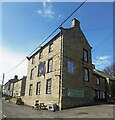
Bowes buildings [1]
Bowes Club, formerly the Bowes and District Working Men's Club, in The Street, was built as a house in the early or mid 18th century. Constructed of sandstone ashlar under a stone slate roof. The link section on the left is in rubble stone. The paired sashes windows have small lunette windows above. Listed, grade II, with details at: https://historicengland.org.uk/listing/the-list/list-entry/1323029
Bowes is a village in County Durham, some 14 miles northwest of Richmond and about 18½ miles due west of Darlington. Set on the north bank of the River Greta, the village was, until by-passed, astride the A66 trunk road. The Romans had a fort here, guarding the Stainmore pass over the Pennines, and their site was reused by the Normans who built a castle. The village grew around the castle, and the name Bowes is first mentioned in a charter of 1148.
Image: © Michael Dibb
Taken: 25 Jun 2022
0.04 miles
4
The Street, Bowes
Looking westwards along the main village street in Bowes. The 3-storey building on the right is the Ancient Unicorn public house which is confirmed as open for business and serving food all day every day (see also
Image). On the corner to the left is what is presumed to be the village emblem (see
Image).
Image: © Oliver Dixon
Taken: 18 Jan 2017
0.04 miles
5
Bowes houses [2]
Numbers 1 and 2 The Street are a pair of houses built in the mid or late 18th century with later alterations. Constructed of rubble stone under an artificial stone roof. Listed, grade II, with details at: https://historicengland.org.uk/listing/the-list/list-entry/1159738
Bowes is a village in County Durham, some 14 miles northwest of Richmond and about 18½ miles due west of Darlington. Set on the north bank of the River Greta, the village was, until by-passed, astride the A66 trunk road. The Romans had a fort here, guarding the Stainmore pass over the Pennines, and their site was reused by the Normans who built a castle. The village grew around the castle, and the name Bowes is first mentioned in a charter of 1148.
Image: © Michael Dibb
Taken: 25 Jun 2022
0.04 miles
6
The Street, Bowes
Looking east down the main village street in Bowes. The 3-storey building on the left is the Ancient Unicorn public house which is confirmed as open for business and serving food all day every day (see also
Image)
Image: © Oliver Dixon
Taken: 18 Jan 2017
0.05 miles
7
Bowes features [2]
An elderly RAC 'Get You Home' sign in The Street.
Bowes is a village in County Durham, some 14 miles northwest of Richmond and about 18½ miles due west of Darlington. Set on the north bank of the River Greta, the village was, until by-passed, astride the A66 trunk road. The Romans had a fort here, guarding the Stainmore pass over the Pennines, and their site was reused by the Normans who built a castle. The village grew around the castle, and the name Bowes is first mentioned in a charter of 1148.
Image: © Michael Dibb
Taken: 25 Jun 2022
0.05 miles
8
Back Lane at Bowes
Image: © Andrew Tatlow
Taken: 1 Aug 2007
0.06 miles
9
The Ancient Unicorn Public House
Image: © Anthony Parkes
Taken: 22 Apr 2022
0.06 miles
10
Crossroads in Bowes
Image: © David Brown
Taken: 24 Jul 2018
0.06 miles


![Bowes houses [3]](https://s2.geograph.org.uk/geophotos/07/33/30/7333058_842b947b_120x120.jpg)
![Bowes buildings [1]](https://s2.geograph.org.uk/geophotos/07/33/30/7333054_cccc0490_120x120.jpg)

![Bowes houses [2]](https://s1.geograph.org.uk/geophotos/07/33/30/7333053_35f3ac31_120x120.jpg)

![Bowes features [2]](https://s0.geograph.org.uk/geophotos/07/33/31/7333148_94906e75_120x120.jpg)


