
IMAGES TAKEN NEAR TO
Westwick, BARNARD CASTLE, DL12 8UL
Introduction
This page details the photographs taken nearby to DL12 8UL by members of the Geograph project.
The Geograph project started in 2005 with the aim of publishing, organising and preserving representative images for every square kilometre of Great Britain, Ireland and the Isle of Man.

There are currently over 7.5m images from over14,400 individuals and you can help contribute to the project by visiting https://www.geograph.org.uk
Image Map
Images are licensed for reuse under creativecommons.org/licenses/by-sa/2.0
Notes
- Clicking on the map will re-center to the selected point.
- The higher the marker number, the further away the image location is from the centre of the postcode.
Image Listing (163 Images Found)
Images are licensed for reuse under creativecommons.org/licenses/by-sa/2.0
Image
Details
Distance

2
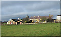
Mains House
Mains House is a farm on the north side of the River Tees near to Abbey Bridge.
Image: © Trevor Littlewood
Taken: 25 Nov 2012
0.01 miles

4

Up from the river towards Mains House
The path along the north side of the River Tees downstream of Barnard Castle is a popular walk despite its proximity to the sewage works. This seems particularly true for dog owners - watch where you step! It can be followed not far above the river to Abbey Bridge (right edge of the photo) for a longer route back via Egglestone Abbey or followed up this track to the road, where there is a convenient layby.
Image: © Andy Waddington
Taken: 11 Mar 2010
0.09 miles
5
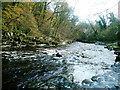
Starting the descent of Abbey Rapids
Above Barnard Castle, the River Tees has become a relatively easy paddle, but downstream, it cuts down again into a short gorge forming rapids a grade harder than those for many kilometres upstream. An initial wide boulder garden narrows down to a series of bedrock ledges with good eddies both sides. As the river curves left towards Abbey bridge, it narrows between short cliffs, and the ledge drops get bigger with the flow more concentrated towards the left in moderate levels such as seen here. The final drop has a grippy stopper to the right, and often a haystack in the main flow and is the scene of many upsets. Fortunately, the gorge under the bridge has deeper, slow-flowing water and is a convenient site for fishing out swimmers and equipment in all but the highest flows. The rapids are a very popular site for park-and-play boating, or as part of a longer trip such as Barnard Castle to Whorlton, or on down to Winston. They are also the scene of slalom competitions from time to time.
Image: © Andy Waddington
Taken: 5 Nov 2009
0.10 miles
6
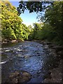
Abbey Rapids
The start of Abbey Rapids where the river Tees runs through a gorge near Egglestone Abbey.
Image: © David Robinson
Taken: 28 May 2015
0.10 miles

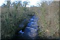
10
River Tees upstream of Abbey Bridge
Image: © Anthony Foster
Taken: 15 Apr 2016
0.11 miles