IMAGES TAKEN NEAR TO
Marwood, BARNARD CASTLE, DL12 8SR
Introduction
This page details the photographs taken nearby to DL12 8SR by members of the Geograph project.
The Geograph project started in 2005 with the aim of publishing, organising and preserving representative images for every square kilometre of Great Britain, Ireland and the Isle of Man.

There are currently over 7.5m images from over14,400 individuals and you can help contribute to the project by visiting https://www.geograph.org.uk
Image Map
Images are licensed for reuse under creativecommons.org/licenses/by-sa/2.0
Notes
- Clicking on the map will re-center to the selected point.
- The higher the marker number, the further away the image location is from the centre of the postcode.
Image Listing (12 Images Found)
Images are licensed for reuse under creativecommons.org/licenses/by-sa/2.0
Image
Details
Distance
1
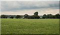
Nevison House
Fields near Nevison House Farm.
Image: © Peter McDermott
Taken: 2 Sep 2011
0.10 miles
2
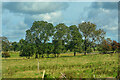
Marwood : Grassy Field
A grassy field with trees.
Image: © Lewis Clarke
Taken: 25 Sep 2020
0.18 miles
3
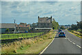
Marwood : B6278
Looking along the B6278.
Image: © Lewis Clarke
Taken: 25 Sep 2020
0.18 miles
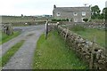
4
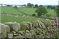
From High Park Wall
Looking across the northern part of the square towards Stonecross. The fields are sheep pasture, sloping down towards the River Tees.
Image: © Graham Horn
Taken: 28 Jun 2008
0.23 miles
5
Marwood : Whin Park
Looking towards Whin Park.
Image: © Lewis Clarke
Taken: 25 Sep 2020
0.23 miles
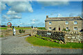
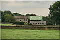
6
Whin Park
Whin Park is a house on the B6278 north of Barnard Castle; OS flush bracket G3181 is fixed to it.
Image: © Trevor Littlewood
Taken: 30 Jul 2007
0.24 miles
7
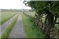
High Park Wall farm road
Looking away from the farm back towards the B6278.
Image: © Graham Horn
Taken: 28 Jun 2008
0.24 miles
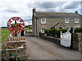
8
Whin Park
From the High Park Wall farm road the other side of the B6278.
Image: © Graham Horn
Taken: 28 Jun 2008
0.24 miles
10
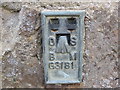
Ordnance Survey Flush Bracket G3181
This can be found on the wall of a private dwelling at Whin Park. The benchmark height is recorded as being 247.17 metres above sea level.
For more detail see : http://www.bench-marks.org.uk/bm15181
Image: © Peter Wood
Taken: 28 Mar 2017
0.25 miles