IMAGES TAKEN NEAR TO
West Layton, RICHMOND, DL11 7PR
Introduction
This page details the photographs taken nearby to DL11 7PR by members of the Geograph project.
The Geograph project started in 2005 with the aim of publishing, organising and preserving representative images for every square kilometre of Great Britain, Ireland and the Isle of Man.

There are currently over 7.5m images from over14,400 individuals and you can help contribute to the project by visiting https://www.geograph.org.uk
Image Map
Images are licensed for reuse under creativecommons.org/licenses/by-sa/2.0
Notes
- Clicking on the map will re-center to the selected point.
- The higher the marker number, the further away the image location is from the centre of the postcode.
Image Listing (13 Images Found)
Images are licensed for reuse under creativecommons.org/licenses/by-sa/2.0
Image
Details
Distance
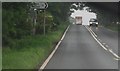
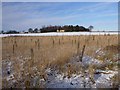
2
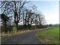
Road, West Layton
The road to East Layton at the edge of the small village.
Image: © Andrew Smith
Taken: 7 Jan 2012
0.07 miles
3
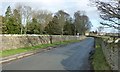
Collier Lane, heading north into West Layton
The trees are in the grounds of West Layton Manor.
Image: © Christine Johnstone
Taken: 17 Feb 2017
0.10 miles
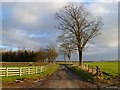
4
New track, south-east of West Layton Manor
Running east from Collier Lane, along a field boundary. Unmapped, but definitely there!
Image: © Christine Johnstone
Taken: 17 Feb 2017
0.14 miles
5
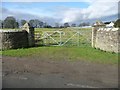
Gated entrance to the nurseries, West Layton
Part of the West Layton Manor estate. On the west side of Collier Lane.
Image: © Christine Johnstone
Taken: 17 Feb 2017
0.14 miles
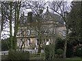
6
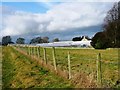
Greenhouses at West Layton Manor
The manor is now run as a B&B. The greenhouses are mapped as 'nurseries' but do not appear to be open to the public.
Image: © Christine Johnstone
Taken: 17 Feb 2017
0.16 miles
7
Field bounded by Collier Lane and the A66
Traffic on the A66 can be seen amongst the trees.
Image: © Christine Johnstone
Taken: 17 Feb 2017
0.17 miles
8
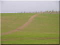
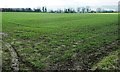
Bridleway near West Layton
The bridleway crosses this arable field to take riders and walkers towards Hutton Fields.
Image: © Maigheach-gheal
Taken: 5 Apr 2011
0.20 miles
9
Burnt House, with new plantation
Surrounded by woodland except to the south where it opens onto West Lane, Burnt House has an uninterrupted view over almost level fields towards the noisy A66. However, a large triangular plantation has been recently created here to its southeast which will eventually block some of the sound of passing trucks. Unlike many plantations, this one seems to be mainly (if not entirely) composed of deciduous trees including oak and birch.
Image: © Andy Waddington
Taken: 28 Nov 2010
0.22 miles