IMAGES TAKEN NEAR TO
Tunstall, RICHMOND, DL10 7QN
Introduction
This page details the photographs taken nearby to DL10 7QN by members of the Geograph project.
The Geograph project started in 2005 with the aim of publishing, organising and preserving representative images for every square kilometre of Great Britain, Ireland and the Isle of Man.

There are currently over 7.5m images from over14,400 individuals and you can help contribute to the project by visiting https://www.geograph.org.uk
Image Map
Images are licensed for reuse under creativecommons.org/licenses/by-sa/2.0
Notes
- Clicking on the map will re-center to the selected point.
- The higher the marker number, the further away the image location is from the centre of the postcode.
Image Listing (40 Images Found)
Images are licensed for reuse under creativecommons.org/licenses/by-sa/2.0
Image
Details
Distance
1
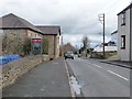
Phone box, Tunstall
Just about in the middle of this rather long village.
Image: © Christine Johnstone
Taken: 26 Feb 2011
0.03 miles
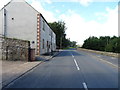
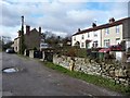
2
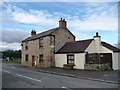
Stone-built house
On the main road through Tunstall.
Image: © Christine Johnstone
Taken: 26 Feb 2011
0.04 miles
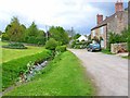
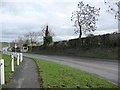
4
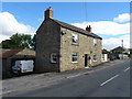
Footpath along village street
This continues into South View.
Image: © Christine Johnstone
Taken: 26 Feb 2011
0.06 miles
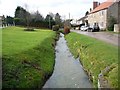
5
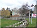
Tunstall Beck
At the eastern end of the attractive village of Tunstall
Image: © Oliver Dixon
Taken: 18 May 2006
0.08 miles
6
Tunstall Beck
Upstream of the road bridge.
Image: © Christine Johnstone
Taken: 26 Feb 2011
0.08 miles
8
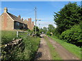
Down by the beck
Cottages and access lane on the line of a footpath close by Tunstall Beck.
Image: © Gordon Hatton
Taken: 14 Jun 2020
0.09 miles
9
South View, Tunstall
Facing Tunstall Beck.
Image: © Christine Johnstone
Taken: 26 Feb 2011
0.09 miles
10
Tunstall bus stop
A solid bus shelter at the eastern end of the village.
Image: © Christine Johnstone
Taken: 26 Feb 2011
0.11 miles