1
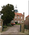
Scorton old Grammar School clock from Back Lane
Dusktime lighting of the clock tower on the building that used to be part of the Grammar School, which closed in 1991 and is now houses.
More at https://en.wikipedia.org/wiki/Scorton_Grammar_School
Image: © Nick W
Taken: 23 Nov 2021
0.04 miles
2
Scorton old grammar school
The main building of the former independent grammar school in Scorton, which closed a few years ago. Now converted into residential units.
Image: © Gordon Hatton
Taken: 14 Feb 2009
0.04 miles
3
Period properties in Scorton
Two attractive houses in Scorton. The nearer one looks to be older than the 18th century Leonard House to the right, which was once the residence of the grammar school headmaster.
Image: © Gordon Hatton
Taken: 14 Feb 2009
0.05 miles
4
Old grammar school, Scorton
The school main building of the former independent grammar school in Scorton with Oak house on the right. Now converted into residential units the school was founded 1720 and closed around 1991 I think.
Image: © wfmillar
Taken: 29 May 2009
0.06 miles
5
Mill House, Scorton
This looks like two houses knocked into one as the right hand side looks older than the left. Could it be early 18th century? A nice sundial on the wall facing out over the green.
Image: © Gordon Hatton
Taken: 14 Feb 2009
0.07 miles
6
The Farmers Arms, Scorton
Cosy village pub looking out over the green.
Image: © Gordon Hatton
Taken: 14 Feb 2009
0.07 miles
7
Silage Field, Scorton
Silage has just been harvested. Residential housing on the north of Scorton
Image: © wfmillar
Taken: 29 May 2009
0.07 miles
8
North access road to Scorton
This is the road into Scorton from Moulton and Middleton Tyas.
Image: © Tony Simms
Taken: 26 Apr 2015
0.07 miles
9
The Farmer's Arms, Scorton
The last pub on the green. The other one is now a bar and restaurant.
Image: © Christine Johnstone
Taken: 14 Dec 2010
0.07 miles
10
Houses in Scorton
Scorton has a range of attractive houses dating from the 18th and 19th centuries.
Image: © Gordon Hatton
Taken: 14 Feb 2009
0.08 miles


