IMAGES TAKEN NEAR TO
RICHMOND, DL10 4SD
Introduction
This page details the photographs taken nearby to DL10 4SD by members of the Geograph project.
The Geograph project started in 2005 with the aim of publishing, organising and preserving representative images for every square kilometre of Great Britain, Ireland and the Isle of Man.

There are currently over 7.5m images from over14,400 individuals and you can help contribute to the project by visiting https://www.geograph.org.uk
Image Map
Images are licensed for reuse under creativecommons.org/licenses/by-sa/2.0
Notes
- Clicking on the map will re-center to the selected point.
- The higher the marker number, the further away the image location is from the centre of the postcode.
Image Listing (25 Images Found)
Images are licensed for reuse under creativecommons.org/licenses/by-sa/2.0
Image
Details
Distance
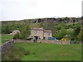
3
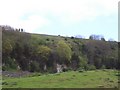
Approach to East Applegarth
With Whitcliffe Wood beyond.
Image: © John Allan
Taken: 11 Sep 2018
0.09 miles
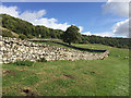
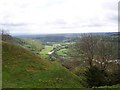
5
Whitcliffe Scar, Willance's Leap Memorial on skyline
Image: © Joe Regan
Taken: 12 May 2007
0.12 miles
6
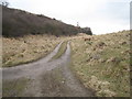
Access track to Hutchinson House
This photograph shows a view of part of the access track that leads across from High Applegarth to Hutchinson House. The picture was taken from the south-going public footpath - looking in an easterly direction towards East Applegarth.
Image: © Philip Barker
Taken: 14 Feb 2010
0.13 miles
7
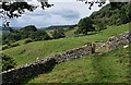
Low Applegarth
Looking along the bridleway towards West Applegarth.
Image: © Peter McDermott
Taken: 19 Aug 2011
0.13 miles
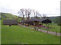
8
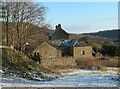
Low Applegarth
House and farm buildings below Whitcliffe Scar and high above the Swale.
Image: © Gordon Hatton
Taken: 5 Jan 2022
0.14 miles
9
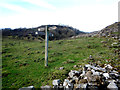
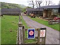
Waymarker sign at Applegarth
There has been a long running dispute over the Applegarth bridleway, eventually resolved in the favour of the majority over the narrow interest of one landowner. One result seems to have been a significant increase in the signage along the bridleway and adjoining footpaths. It's always good to have adequate waymarking in places where one might otherwise accidentally stray off the exact correct route - landowners never seem to accept that they only have themselves to blame if people miss the way. The route on these paths was pretty obvious - the signage merely serves to get the message across to those who don't like public rights of way.
Image: © Andy Waddington
Taken: 5 Jan 2019
0.15 miles
10
River Swale, Whitcliffe Wood to the left
Image: © Joe Regan
Taken: 12 May 2007
0.15 miles