
IMAGES TAKEN NEAR TO
Mowlam Drive, STANLEY, DH9 6YZ
Introduction
This page details the photographs taken nearby to Mowlam Drive, DH9 6YZ by members of the Geograph project.
The Geograph project started in 2005 with the aim of publishing, organising and preserving representative images for every square kilometre of Great Britain, Ireland and the Isle of Man.

There are currently over 7.5m images from over14,400 individuals and you can help contribute to the project by visiting https://www.geograph.org.uk
Image Map
Images are licensed for reuse under creativecommons.org/licenses/by-sa/2.0
Notes
- Clicking on the map will re-center to the selected point.
- The higher the marker number, the further away the image location is from the centre of the postcode.
Image Listing (11 Images Found)
Images are licensed for reuse under creativecommons.org/licenses/by-sa/2.0
Image
Details
Distance

4

View east along Humber Hill road
This road forms the southern boundary of the large housing estate at East Stanley.
Image: © Robert Graham
Taken: 13 Sep 2019
0.17 miles
5

Entrance to Burnside Primary School
This school is in a pleasant spot on the edge of the woods on the east side of a large housing estate at South Stanley.
Image: © Robert Graham
Taken: 16 Sep 2019
0.20 miles
6

Signboard and sculpture at Burnside
These are on the edge of the woods opposite Burnside Primary School at South Stanley.
Image: © Robert Graham
Taken: 16 Sep 2019
0.22 miles
7
Housing estate at Humber Hill
One of several large estates built at South Stanley. Built part way up the slope below Stanley town centre, there are extensive views south and east across Co Durham.
Image: © Robert Graham
Taken: 13 Sep 2019
0.23 miles


10
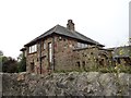
Stone house on East Stanley Estate
This house looks a bit out of place on this 1960's housing estate, but was here first. A plaque on the front wall states that it was built by William Bell in 1954-55, on what would have been an open site. Billy Bell was a well known local scrap man made good. The name Stanley Hall is taken from an old manor house which stood very near this spot from medieval times until the 1930's when it was demolished.
Image: © Robert Graham
Taken: 13 Sep 2019
0.24 miles