
IMAGES TAKEN NEAR TO
DH9 6SY
Introduction
This page details the photographs taken nearby to DH9 6SY by members of the Geograph project.
The Geograph project started in 2005 with the aim of publishing, organising and preserving representative images for every square kilometre of Great Britain, Ireland and the Isle of Man.

There are currently over 7.5m images from over14,400 individuals and you can help contribute to the project by visiting https://www.geograph.org.uk
Image Map
Images are licensed for reuse under creativecommons.org/licenses/by-sa/2.0
Notes
- Clicking on the map will re-center to the selected point.
- The higher the marker number, the further away the image location is from the centre of the postcode.
Image Listing (8 Images Found)
Images are licensed for reuse under creativecommons.org/licenses/by-sa/2.0
Image
Details
Distance
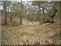
2
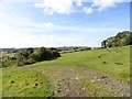
View west from High Twizell
This site, in the fields west of West Pelton, was once the site of High Twizell farm. It must have disappeared some time in the second half of the 20th century. There is a nice view from here over the countryside towards South Stanley and Craghead.
Image: © Robert Graham
Taken: 16 Sep 2019
0.11 miles
3
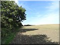
Looking along the line of the old railway near Eden Hill
This is looking west from the site of the old farm at High Twizell. The trees mark the route of the line to Stanley. This was originally part of the very early Stanhope and Tyne Railway of 1834. This section of the line was bypassed by the Beamish diversion in 1893, but carried on in use for colliery traffic until 1946. Unlike a lot of former railways in the area, this one has not been converted into a footpath, and there is no public access to the surviving bits of the route.
Image: © Robert Graham
Taken: 16 Sep 2019
0.14 miles
4

Gateway onto the old line near Eden Hill
This old railway ran across the fields west of West Pelton to Stanley and was used for colliery traffic. It ceased operations in 1946 and was lifted in 1952, but the route can still be traced in parts, such as here. The public path crosses it here, at the site of an old farm called High Twizell. This is shown on old O S maps of the 1920's and earlier but must have been abandoned and cleared years ago.
Image: © Robert Graham
Taken: 16 Sep 2019
0.17 miles
5

Path through the fields west of Eden Hill
This footpath and farm track runs north from Twizell Lane near the site of the former Jingling Gates pub (now demolished) and crosses the track of the old railway at the top of the picture here. The line of the trackway can be clearly made out, along the top of the embankment. It ceased operating in 1946.
Image: © Robert Graham
Taken: 16 Sep 2019
0.20 miles
7

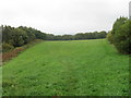
Stile on the field path near Eden Hill
This path runs over the fields north of Twizell Lane, near West Pelton. The embankment ahead marks the line of an old railway which closed in 1946. It was used solely for colliery traffic.
Image: © Robert Graham
Taken: 16 Sep 2019
0.21 miles
8
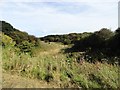
Looking down Acton Dene
View south from the path from No Place. This is an area of scrubby woodland to the east of Stanley.
Image: © Robert Graham
Taken: 16 Sep 2019
0.22 miles