
IMAGES TAKEN NEAR TO
STANLEY, DH9 6RS
Introduction
This page details the photographs taken nearby to DH9 6RS by members of the Geograph project.
The Geograph project started in 2005 with the aim of publishing, organising and preserving representative images for every square kilometre of Great Britain, Ireland and the Isle of Man.

There are currently over 7.5m images from over14,400 individuals and you can help contribute to the project by visiting https://www.geograph.org.uk
Image Map
Images are licensed for reuse under creativecommons.org/licenses/by-sa/2.0
Notes
- Clicking on the map will re-center to the selected point.
- The higher the marker number, the further away the image location is from the centre of the postcode.
Image Listing (16 Images Found)
Images are licensed for reuse under creativecommons.org/licenses/by-sa/2.0
Image
Details
Distance
1
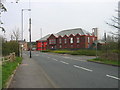
Fire Station High Handenhold
High Handenhold Fire Station was opened on 9th October 1997 and provides fire and rescue cover for approximately 89 sq km (34.5 sq m) bordering with Tyne and Wear Metropolitan Fire Brigade.
Image: © Les Hull
Taken: 24 Apr 2006
0.10 miles
3
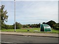
Chlildren's play area, West Pelton
At the west end of the village, opposite the church.
Image: © Robert Graham
Taken: 16 Sep 2019
0.16 miles
4
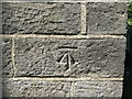
Ordnance Survey Cut Mark
This mark can be found on the wall of St Paul's Church in West Pelton.
For more detail see : http://www.bench-marks.org.uk/bm95764
Image: © Peter Wood
Taken: 19 May 2018
0.16 miles
5
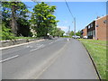
St Paul's Terrace, West Pelton
Looking north-westward towards the A693.
Image: © Peter Wood
Taken: 19 May 2018
0.17 miles
6
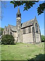
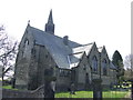
The Church of St Paul at West Pelton
Viewed from the south-east.
Image: © Peter Wood
Taken: 19 May 2018
0.17 miles
7
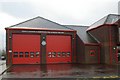
High Handenhold fire station
High Handenhold fire station, Pelton, Chester-Le-Street, County Durham, showing the appliance bays, in contrast to the more distant shot in Image
Image: © Kevin Hale
Taken: 26 Nov 2006
0.17 miles
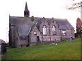
10
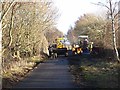
Repair work on the Consett and Sunderland Railway Path
The Consett and Sunderland Railway Path forms part of National Cycle Network route 7 and the famous C2C Cycle Route. This section is tarmac, and maintenance work is being conducted on the bridge over Stony Lane.
Image: © Oliver Dixon
Taken: 8 Jan 2014
0.18 miles