IMAGES TAKEN NEAR TO
Blanchland, CONSETT, DH8 9PT
Introduction
This page details the photographs taken nearby to DH8 9PT by members of the Geograph project.
The Geograph project started in 2005 with the aim of publishing, organising and preserving representative images for every square kilometre of Great Britain, Ireland and the Isle of Man.

There are currently over 7.5m images from over14,400 individuals and you can help contribute to the project by visiting https://www.geograph.org.uk
Image Map
Images are licensed for reuse under creativecommons.org/licenses/by-sa/2.0
Notes
- Clicking on the map will re-center to the selected point.
- The higher the marker number, the further away the image location is from the centre of the postcode.
Image Listing (13 Images Found)
Images are licensed for reuse under creativecommons.org/licenses/by-sa/2.0
Image
Details
Distance
1
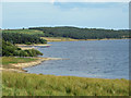
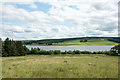
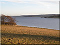
Banks of Derwent Reservoir
The masts of the boats anchored at the sailing club can be seen on the left.
Image: © Pauline E
Taken: 26 Jul 2014
0.04 miles
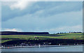
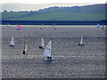
3
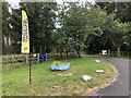
Entrance to Derwent Reservoir Sailing Club
Image: © David Robinson
Taken: 12 Jul 2022
0.10 miles
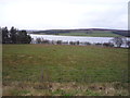
5
Field descending towards Derwent Reservoir
A roughly grassed field with Derwent Reservoir below.
Image: © Trevor Littlewood
Taken: 15 Jul 2015
0.14 miles
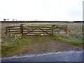
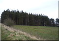
10
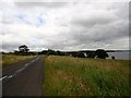
View along the road near Bale Hill
Looking east along the country road which runs along the north side of Derwent Reservoir.
Image: © Robert Graham
Taken: 21 Jul 2015
0.17 miles