
IMAGES TAKEN NEAR TO
Hownsgill Drive, CONSETT, DH8 9HU
Introduction
This page details the photographs taken nearby to Hownsgill Drive, DH8 9HU by members of the Geograph project.
The Geograph project started in 2005 with the aim of publishing, organising and preserving representative images for every square kilometre of Great Britain, Ireland and the Isle of Man.

There are currently over 7.5m images from over14,400 individuals and you can help contribute to the project by visiting https://www.geograph.org.uk
Image Map
Images are licensed for reuse under creativecommons.org/licenses/by-sa/2.0
Notes
- Clicking on the map will re-center to the selected point.
- The higher the marker number, the further away the image location is from the centre of the postcode.
Image Listing (4 Images Found)
Images are licensed for reuse under creativecommons.org/licenses/by-sa/2.0
Image
Details
Distance
1
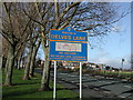
Delves Lane road sign
Road sign, road and housing at south end of village
Image: © Vivienne Smith
Taken: 11 Jan 2006
0.21 miles
2
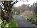
Lanchester Valley Railway Path
The Lanchester Valley Railway Path (part of National Cycle Network route 14) follows the line of the old railway from Durham to Lydgetts Junction. Popular with dog walkers.
Image: © Oliver Dixon
Taken: 13 Nov 2012
0.22 miles
3
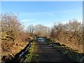
Lanchester Railway Walk in winter
East of Knitsley Lane. There has been ditch clearing work carried out recently, as can be seen on the left.
Image: © Robert Graham
Taken: 1 Jan 2020
0.22 miles
4
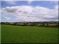
View down the valley
Looking from the bottom of Templetown down the valley towards Lanchester. Factories at Delves Lane on the left.
Image: © Robert Graham
Taken: 21 Jul 2011
0.24 miles