IMAGES TAKEN NEAR TO
Knitsley, CONSETT, DH8 9HA
Introduction
This page details the photographs taken nearby to DH8 9HA by members of the Geograph project.
The Geograph project started in 2005 with the aim of publishing, organising and preserving representative images for every square kilometre of Great Britain, Ireland and the Isle of Man.

There are currently over 7.5m images from over14,400 individuals and you can help contribute to the project by visiting https://www.geograph.org.uk
Image Map
Images are licensed for reuse under creativecommons.org/licenses/by-sa/2.0
Notes
- Clicking on the map will re-center to the selected point.
- The higher the marker number, the further away the image location is from the centre of the postcode.
Image Listing (10 Images Found)
Images are licensed for reuse under creativecommons.org/licenses/by-sa/2.0
Image
Details
Distance
1
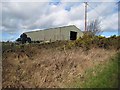
Barn at Red Houses Farm
On Knitsley Lane.
Image: © Oliver Dixon
Taken: 6 Mar 2007
0.08 miles
2
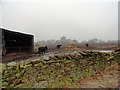
Cattle near Red Houses
A small hamlet south of Knitsley, near Consett. These cattle in a rather muddy yard are a beef breed, probably Aberdeen Angus.
Image: © Robert Graham
Taken: 6 Mar 2013
0.11 miles
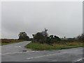
3
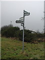
Signpost at meeting of country roads
Sign for roads leading to Rowley, Delves, Broadmeadows, Butsfield, Lanchester
Image: © Vivienne Smith
Taken: 9 Jan 2006
0.13 miles
4
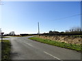
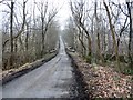
Crossroads on Longedge Lane
Two other roads join up with the lane here, a short way south of Woodlands. The lane is running left to right across the photo, with Eliza Lane coming in from the left.
Image: © Robert Graham
Taken: 11 Mar 2012
0.17 miles
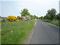
6
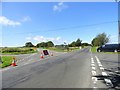
Five ways junction on Longedge Lane
This junction sees Longedge Lane crossed here by the road coming from the left from Knitsley. There is also another road on the left called Eliza Lane which runs SW to the A68.
Image: © Robert Graham
Taken: 23 Jul 2019
0.19 miles
7
Sheep at gate in ruined wall
The view is from a minor road known as Eliza Lane over the valley of the Rippon Burn.
Image: © Trevor Littlewood
Taken: 9 Nov 2013
0.22 miles
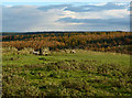
8
View from Eliza Lane
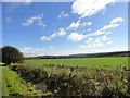
Looking SE over the countryside towards the Browney valley west of Lanchester.
Image: © Robert Graham
Taken: 24 Sep 2014
0.22 miles
9
Redhouses Bridge
Where the lane from East Butsfield to Knitsley crosses the Rippon Burn, south of Longedge Lane.
Image: © Robert Graham
Taken: 6 Mar 2013
0.23 miles