IMAGES TAKEN NEAR TO
CONSETT, DH8 9EL
Introduction
This page details the photographs taken nearby to DH8 9EL by members of the Geograph project.
The Geograph project started in 2005 with the aim of publishing, organising and preserving representative images for every square kilometre of Great Britain, Ireland and the Isle of Man.

There are currently over 7.5m images from over14,400 individuals and you can help contribute to the project by visiting https://www.geograph.org.uk
Image Map
Images are licensed for reuse under creativecommons.org/licenses/by-sa/2.0
Notes
- Clicking on the map will re-center to the selected point.
- The higher the marker number, the further away the image location is from the centre of the postcode.
Image Listing (17 Images Found)
Images are licensed for reuse under creativecommons.org/licenses/by-sa/2.0
Image
Details
Distance
1
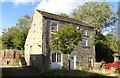
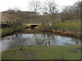
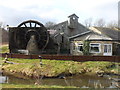
The old mill at Knitsley Mill
This charming old building is a short distance south of Consett in rural surroundings. There was a corn mill here in earlier times.
Image: © Robert Graham
Taken: 30 Sep 2019
0.01 miles
2
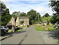
Old buildings at Knitsley Mill
This was a corn mill in earlier times, powered by a waterwheel taking water from the Knitsley Burn. It is situated near Butsfield Lane, on the south west side of Consett.
Image: © Robert Graham
Taken: 5 Aug 2019
0.01 miles
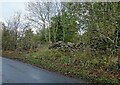
6
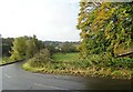
Autumn colours on Butsfield Lane
Looking down the lane towards Knitsley Mill. The tree colours seem particularly fine this year.
Image: © Robert Graham
Taken: 20 Oct 2020
0.12 miles
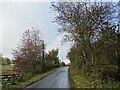
7
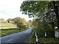
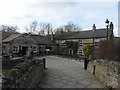
Looking north up Butsfield Lane
This lane runs south from Delves Lane in Consett out into the countryside. Viewed from next to Knitsley Mill.
Image: © Robert Graham
Taken: 20 Oct 2020
0.16 miles
8
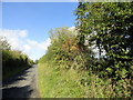
Autumn hedge along the lane
Hawthorn berries and Rose Hips on bushes in the hedge here. This is the lane between Knitsley Mill and High Knitsley, south of Consett.
Image: © Robert Graham
Taken: 30 Sep 2019
0.20 miles
9
Old stone wall on Outputs Lane
This lane runs through the countryside south of Consett.
Image: © Robert Graham
Taken: 20 Oct 2020
0.20 miles
10
Looking along Outputs Lane
View looking west along the road. This country lane is one of those created after the Lanchester Commons Enclosure of 1783, so presumably dates from the late 18th century. These enclosure roads stand out on the map as usually a lot straighter than earlier ones, except those which had Roman origins.
Image: © Robert Graham
Taken: 20 Oct 2020
0.21 miles