
IMAGES TAKEN NEAR TO
Rowley, CONSETT, DH8 9AQ
Introduction
This page details the photographs taken nearby to DH8 9AQ by members of the Geograph project.
The Geograph project started in 2005 with the aim of publishing, organising and preserving representative images for every square kilometre of Great Britain, Ireland and the Isle of Man.

There are currently over 7.5m images from over14,400 individuals and you can help contribute to the project by visiting https://www.geograph.org.uk
Image Map
Images are licensed for reuse under creativecommons.org/licenses/by-sa/2.0
Notes
- Clicking on the map will re-center to the selected point.
- The higher the marker number, the further away the image location is from the centre of the postcode.
Image Listing (65 Images Found)
Images are licensed for reuse under creativecommons.org/licenses/by-sa/2.0
Image
Details
Distance
1
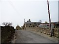
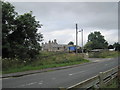
Mainsfield Farm, Rowley
This old farmstead stands beside the A68 on the south edge of the little hamlet of Rowley. The old Stanhope and Tyne Railway once ran past, but the farm would have been here long before the railway, which was built in the 1830's.
Image: © Robert Graham
Taken: 6 May 2016
0.00 miles
2
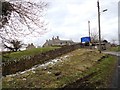
Entrance to Rowley Baptist Church
Viewed from the A68, which passes through this little hamlet near Castleside.
Image: © Robert Graham
Taken: 13 Mar 2013
0.01 miles
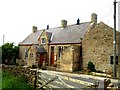
4
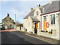
Rowley Baptist Church
The church has two date-stones on the porch, one above the other. The brownish, rectangular one above the window tells that the church was rebuilt in 1823. The stone above, possibly an original from the time of the construction, tells that it was built in 1652, that date being cut in Roman numerals; the inscription is unusual however in that the lettering is MCCCCCCLII, rather than MDCLII.
Image: © Trevor Littlewood
Taken: 11 Feb 2019
0.01 miles
5

Mainsfield farm, Rowley
This old farm is right beside the Baptist Chapel at the hamlet of Rowley near Castleside. The chapel is supposed to date back to the 17th century, so perhaps the farm is the same age.
Image: © Robert Graham
Taken: 17 Jul 2013
0.01 miles
7
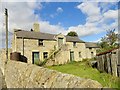
Old farm at Rowley
This is Mainsfield Farm at the little hamlet of Rowley, on the A68. Looks like the original linear farm range, probably early C19.
Image: © Robert Graham
Taken: 24 Sep 2014
0.02 miles
8
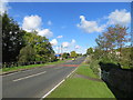
Road (A68) at Dene Bridge near Rowley
Looking north-westward.
Image: © Peter Wood
Taken: 9 Oct 2015
0.04 miles
9
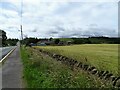
Looking down the A68 at Rowley
View south down the road, with Mainsfield Farm on the right.
Image: © Robert Graham
Taken: 13 Jul 2020
0.05 miles
10
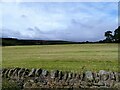
View west from the A68 at Rowley
Looking over the fields to Whitehall farm and the Moss behind.
Image: © Robert Graham
Taken: 13 Jul 2020
0.05 miles