
IMAGES TAKEN NEAR TO
Tyne Avenue, CONSETT, DH8 6HB
Introduction
This page details the photographs taken nearby to Tyne Avenue, DH8 6HB by members of the Geograph project.
The Geograph project started in 2005 with the aim of publishing, organising and preserving representative images for every square kilometre of Great Britain, Ireland and the Isle of Man.

There are currently over 7.5m images from over14,400 individuals and you can help contribute to the project by visiting https://www.geograph.org.uk
Image Map
Images are licensed for reuse under creativecommons.org/licenses/by-sa/2.0
Notes
- Clicking on the map will re-center to the selected point.
- The higher the marker number, the further away the image location is from the centre of the postcode.
Image Listing (35 Images Found)
Images are licensed for reuse under creativecommons.org/licenses/by-sa/2.0
Image
Details
Distance
1
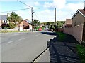
View down Tyne Avenue, Leadgate
Looking north down the bank. This estate, generally called The Pont locally, was built after WW2 I believe, as council housing.
Image: © Robert Graham
Taken: 26 Sep 2022
0.03 miles
2
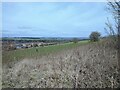
View from the old line in Leadgate
Looking north to the Derwent Valley in the distance from the old railway line behind the village street.
Image: © Robert Graham
Taken: 22 Mar 2021
0.11 miles
3
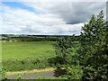
View north from St Ives' Road, Leadgate
The old railway walk is directly in front. The view is over to Medomsley.
Image: © Robert Graham
Taken: 20 Jul 2020
0.12 miles
4
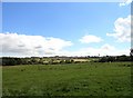
View from the road in front of Pont Bungalows
View across the valley to St Ives Road in Leadgate running along the horizon. The church of that name can be seen in the middle.
Image: © Robert Graham
Taken: 9 Aug 2017
0.13 miles
5
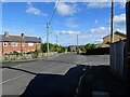
Pont Terrace, Leadgate
The Pont estate was built in the post WW2 period as council housing, on the north side of the existing village.
Image: © Robert Graham
Taken: 26 Sep 2022
0.14 miles
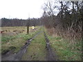
7

View from Watling Bungalows, Leadgate
From the back of Fourth Street, looking north-east
Image: © Oliver Dixon
Taken: 21 Aug 2002
0.15 miles
8
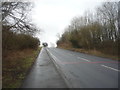
Pont Lane
Heading south east towards the A692.
Image: © JThomas
Taken: 2 Apr 2016
0.16 miles
9

Horses at Leadgate
These horses, in their shaggy winter coats, were in a field beside the old railway west of Leadgate village.
Image: © Robert Graham
Taken: 18 Feb 2014
0.17 miles
10
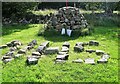
In praise of the NHS
Cairn erected by the locals beside the old railway path through Leadgate village during the recent lockdown.
Image: © Robert Graham
Taken: 14 Sep 2020
0.18 miles