
IMAGES TAKEN NEAR TO
Troon Close, CONSETT, DH8 5XF
Introduction
This page details the photographs taken nearby to Troon Close, DH8 5XF by members of the Geograph project.
The Geograph project started in 2005 with the aim of publishing, organising and preserving representative images for every square kilometre of Great Britain, Ireland and the Isle of Man.

There are currently over 7.5m images from over14,400 individuals and you can help contribute to the project by visiting https://www.geograph.org.uk
Image Map
Images are licensed for reuse under creativecommons.org/licenses/by-sa/2.0
Notes
- Clicking on the map will re-center to the selected point.
- The higher the marker number, the further away the image location is from the centre of the postcode.
Image Listing (11 Images Found)
Images are licensed for reuse under creativecommons.org/licenses/by-sa/2.0
Image
Details
Distance
1
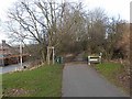
Start of the Derwent Walk
The Derwent Walk is a footpath and cycleway which follows the line of the old Derwent Valley Railway. Constructed in 1867 and running from Swalwell on the River Tyne up to Consett, the line finally closed in 1963. The path is 18km long and forms part of National Cycle Network route 14.
Image: © Oliver Dixon
Taken: 28 Feb 2014
0.07 miles
2
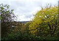
Autumn trees beside the Derwent Walk
On the former railway walk at Shotley Bridge. West side of the Derwent Valley in the distance,
Image: © Robert Graham
Taken: 6 Nov 2023
0.12 miles
3

View along Queen's Road
Looking from the top of the Derwent Walk, along towards Blackhill.
Image: © Robert Graham
Taken: 9 May 2012
0.13 miles
4

Looking south along the Derwent Walk
This is near the southern end of the walk, shortly before it finishes at Blackhill.
Image: © Robert Graham
Taken: 9 May 2012
0.15 miles
5
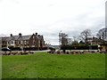
Queen's Road, Shotley Bridge
Some fine old stone houses along this road. This view shows the junction with King's Road.
Image: © Robert Graham
Taken: 17 Apr 2016
0.16 miles
6
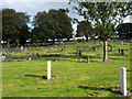
Benfieldside Cemetery
Benfieldside Cemetery is a large burial ground in Consett, north of the town centre. The southern end of it is sloping and almost wooded with older gravestones but the ground seen here, further north, is flatter, more open and has later graves. The two nearest gravestones are of course of the Commonwealth War Graves Commission.
Image: © Trevor Littlewood
Taken: 4 Oct 2016
0.16 miles
7
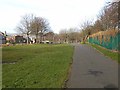
Cycleway alongside Queen's Road, Blackhill
There is a very broad verge on the east side of Queens Road which embraces the old trackbed of the Derwent Valley Railway. Constructed in 1867 and running from Swalwell on the River Tyne up to Consett, the line finally closed in 1963. The footway on the line of the old railway has been converted into a cycleway and forms part of National Cycle Network route 14 which follows a zigzag course from South Shields via Gateshead, Consett, Durham, Hartlepool and Stockton-on-Tees to finish at Darlington.
Image: © Oliver Dixon
Taken: 28 Feb 2014
0.16 miles
8
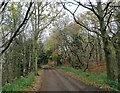
Trees along the Derwent Walk
Although this part of the old railway runs through Shotley Bridge, it looks quite rural. The view is looking north.
Image: © Robert Graham
Taken: 18 Nov 2020
0.18 miles
9
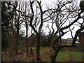
Trees beside the Derwent Walk
This bit of woodland abuts the housing estate beside the southern part of the Derwent Walk, not far from its junction with Queen's Road at Shotley Bridge.
Image: © Robert Graham
Taken: 17 Apr 2016
0.19 miles
10
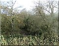
Scrub woodland beside the railway walk
Scrub on the north side of the Derwent Walk. The railway was built on an embankment here across a dip in the land, there is a little stream in the bottom.
Image: © Robert Graham
Taken: 18 Nov 2020
0.21 miles