
IMAGES TAKEN NEAR TO
Shotley Bridge, CONSETT, DH8 0TQ
Introduction
This page details the photographs taken nearby to DH8 0TQ by members of the Geograph project.
The Geograph project started in 2005 with the aim of publishing, organising and preserving representative images for every square kilometre of Great Britain, Ireland and the Isle of Man.

There are currently over 7.5m images from over14,400 individuals and you can help contribute to the project by visiting https://www.geograph.org.uk
Image Map
Images are licensed for reuse under creativecommons.org/licenses/by-sa/2.0
Notes
- Clicking on the map will re-center to the selected point.
- The higher the marker number, the further away the image location is from the centre of the postcode.
Image Listing (37 Images Found)
Images are licensed for reuse under creativecommons.org/licenses/by-sa/2.0
Image
Details
Distance
1
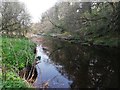
River Derwent between East Law and Shotley Bridge
Image: © Clive Nicholson
Taken: 21 Apr 2019
0.08 miles
2
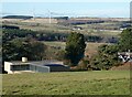
Houses on Westlaw Road
Overlooking the Derwent valley.
Image: © Oliver Dixon
Taken: 16 Dec 2021
0.09 miles
3
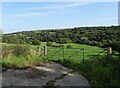
View from Panshield
Looking east over the Derwent Valley from beside the farm at Panshield.
Image: © Robert Graham
Taken: 21 Sep 2020
0.10 miles
4
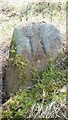
Old Boundary Marker in Park Wood, Consett
Boundary Marker on a bank by the riverside in Park Wood, accessed through Westlaw Wood, Woodland Trust and a path from the A682. On the boundary of Shotley Low Quarter parish in Northumberland and the former Consett parish in County Durham. Inscribed W and E on opposite faces. Grade II Listed details https://historicengland.org.uk/listing/the-list/list-entry/1067544.
Milestone Society National ID: DU_SB05bm
Image: © Mike Rayner
Taken: 9 Feb 2023
0.10 miles
5
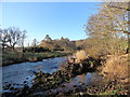
Banks of the River Derwent
Looking south along the river near Panshield farm in Northumberland. Durham is on the opposite bank as the river forms the border between the two counties along this stretch.
Image: © Robert Graham
Taken: 25 Jan 2017
0.11 miles
6
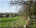
View of Greenwood from the lane
Looking north from the side of West Law Road. The rooftops of Greenwood house can be seen. This is an early Victorian country house north of Shotley Bridge. Built by the Peile family, local landowners.
Image: © Robert Graham
Taken: 30 Mar 2021
0.11 miles
7

Old Boundary Marker in Westlaw Wood, Consett parish
Estate Boundary Marker in parish of Consett (Derwentside District), Westlaw Wood. Access by path from the A694.
Surveyed
Milestone Society National ID: DU_SB04em
Image: © Milestone Society
Taken: Unknown
0.11 miles
8
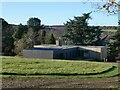
Buchanan House
House of striking modern design on Westlaw Road, overlooking the Derwent valley.
Image: © Oliver Dixon
Taken: 16 Dec 2021
0.11 miles
9
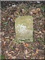
Old Boundary Marker in Westlaw Wood off the A694
Estate Boundary Marker in parish of Consett (Derwentside District), Westlaw Wood, access by path from A694.
Surveyed
Milestone Society National ID: DU_SB03em.
Image: © Milestone Society
Taken: Unknown
0.12 miles
10
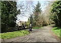
A quiet country lane
This is West Law Lane, which runs through attractive countryside north from Shotley Bridge to Ebchester. Here, it passes Greenwood, a Victorian country house.
Image: © Robert Graham
Taken: 30 Mar 2021
0.13 miles