IMAGES TAKEN NEAR TO
Esh, DURHAM, DH7 9RF
Introduction
This page details the photographs taken nearby to DH7 9RF by members of the Geograph project.
The Geograph project started in 2005 with the aim of publishing, organising and preserving representative images for every square kilometre of Great Britain, Ireland and the Isle of Man.

There are currently over 7.5m images from over14,400 individuals and you can help contribute to the project by visiting https://www.geograph.org.uk
Image Map
Images are licensed for reuse under creativecommons.org/licenses/by-sa/2.0
Notes
- Clicking on the map will re-center to the selected point.
- The higher the marker number, the further away the image location is from the centre of the postcode.
Image Listing (14 Images Found)
Images are licensed for reuse under creativecommons.org/licenses/by-sa/2.0
Image
Details
Distance
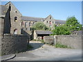
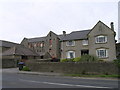
1
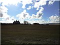
Looking across to Millgate Cottages
Looking east from the path across the fields to Esh village.
Image: © Robert Graham
Taken: 3 Apr 2013
0.01 miles
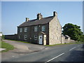
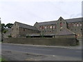
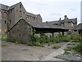
3
Millgate Cottages
Beside the road leading south from Langley Park to Bearpark, at the point where College Road joins the road.
Image: © Robert Graham
Taken: 3 Apr 2013
0.01 miles
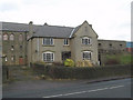
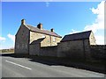
10
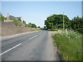
Woodland road near Ushaw Farm
Looking south east.
Image: © JThomas
Taken: 4 Jun 2016
0.18 miles