
IMAGES TAKEN NEAR TO
Acton Road, DURHAM, DH7 9PN
Introduction
This page details the photographs taken nearby to Acton Road, DH7 9PN by members of the Geograph project.
The Geograph project started in 2005 with the aim of publishing, organising and preserving representative images for every square kilometre of Great Britain, Ireland and the Isle of Man.

There are currently over 7.5m images from over14,400 individuals and you can help contribute to the project by visiting https://www.geograph.org.uk
Image Map
Images are licensed for reuse under creativecommons.org/licenses/by-sa/2.0
Notes
- Clicking on the map will re-center to the selected point.
- The higher the marker number, the further away the image location is from the centre of the postcode.
Image Listing (15 Images Found)
Images are licensed for reuse under creativecommons.org/licenses/by-sa/2.0
Image
Details
Distance
1
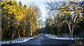
Deerness Valley Railway Path beyond Holburn Bridge
The railway path heading east as it passes Esh Winning and also Holburn Bridge which is a footway over the River Deerness; the rails of its parapets just show at the right side of the image.
Image: © Trevor Littlewood
Taken: 4 Jan 2022
0.06 miles
2
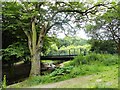
Holburn Bridge, Esh Winning
A footbridge over the River Deerness, south of the village.
Image: © Robert Graham
Taken: 10 Jul 2013
0.08 miles
3
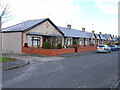
Coronation Homes, Esh Winning
Completed in 1911, these "homes" were presumably built for retired coal miners
Image: © Oliver Dixon
Taken: 3 Apr 2006
0.09 miles
4
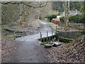
Deerness Valley Railway Path at Esh Winning
This path, one of many railway paths in County Durham, follows the line of an old railway from Durham to Crook. The railway was opened in 1858, closed to passengers in 1951 and finally closed in 1964. Here the path deviates slightly from the track of the railway to cross the River Deerness. There is another crossing of the river a short way further east.
Image: © Oliver Dixon
Taken: 15 Mar 2013
0.11 miles
5
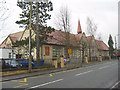
Our Lady Queen of Martyrs R C Primary School, Esh Winning
Image: © Peter Robinson
Taken: 9 Feb 2011
0.13 miles
6
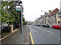
View west down Durham Road, Esh Winning
This is the main road through the village. Esh Winning is a typical Co Durham mid C19 ex mining village.
Image: © Robert Graham
Taken: 29 Jun 2016
0.13 miles
7
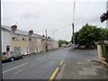
Durham Road, Esh Winning
View north along this road on the south side of the village.
Image: © Robert Graham
Taken: 29 Jun 2016
0.13 miles
8
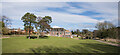
Esh Winning Methodist Church
The Esh Winning Methodist Church seen across an expanse of grass, just above the Deerness Valley Railway Walk, which is just visible at the right side of the image above tree shadows.
Image: © Trevor Littlewood
Taken: 12 Mar 2021
0.15 miles
9
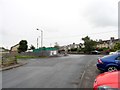
Looking down Fair View, Esh Winning
This is the east end of the road, looking to its junction with Durham Road, the main road through the village.
Image: © Robert Graham
Taken: 29 Jun 2016
0.16 miles
10
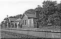
Waterhouses (closed) station,1958
View SW, towards Brancepeth Colliery for mineral traffic. Until closed 29/10/51 it was the terminus of the Dearness Valley branch from Durham of a passenger service of one train a day - also for a service on Durham Miners' Gala Day, once a year until 7/60. Goods trains ran to Brancepeth until 10/8/64, to Waterhouses until 28/12/64. The photograph was taken on the occasion of a Rail Tour.
Image: © Walter Dendy, deceased
Taken: 31 Aug 1958
0.16 miles