
IMAGES TAKEN NEAR TO
The Fold, DURHAM, DH7 9DH
Introduction
This page details the photographs taken nearby to The Fold, DH7 9DH by members of the Geograph project.
The Geograph project started in 2005 with the aim of publishing, organising and preserving representative images for every square kilometre of Great Britain, Ireland and the Isle of Man.

There are currently over 7.5m images from over14,400 individuals and you can help contribute to the project by visiting https://www.geograph.org.uk
Image Map
Images are licensed for reuse under creativecommons.org/licenses/by-sa/2.0
Notes
- Clicking on the map will re-center to the selected point.
- The higher the marker number, the further away the image location is from the centre of the postcode.
Image Listing (37 Images Found)
Images are licensed for reuse under creativecommons.org/licenses/by-sa/2.0
Image
Details
Distance
4

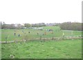
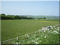
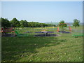
Fields north of Quebec
Fine view to the north across the Browney valley. The farmer is haymaking in the next field.
Image: © Robert Graham
Taken: 15 Aug 2012
0.10 miles
5

Quebec Village from the south
This former mining village gets its rather unusual name because the fields on which it is built were enclosed from the common in 1759, the same year in which Quebec in Canada was captured from the French. It was the fashion at the time to use names of famous victories or places in the empire.
Image: © Robert Graham
Taken: 15 Aug 2012
0.10 miles
7

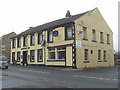
Quebec village street
The Hamsteels Inn, in the centre of the picture, gets its name from nearby Hamsteel Hall. This was the home of the local coal owners - Quebec was a mining village.
Image: © Robert Graham
Taken: 15 Aug 2012
0.11 miles
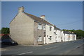
9
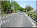
Bus stop and shelter on Front Street, Quebec
Image: © JThomas
Taken: 4 Jun 2016
0.11 miles
10
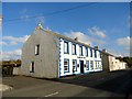
The Hamsteels Inn, Quebec
The pub takes its name from the nearby Hamsteels Colliery, which opened in the late C19. The village at Quebec was built to house the miners, and most of the houses were demolished in the 1950's after the pit closed.
Image: © Robert Graham
Taken: 25 Oct 2016
0.11 miles