
IMAGES TAKEN NEAR TO
Commercial Street, DURHAM, DH7 9BN
Introduction
This page details the photographs taken nearby to Commercial Street, DH7 9BN by members of the Geograph project.
The Geograph project started in 2005 with the aim of publishing, organising and preserving representative images for every square kilometre of Great Britain, Ireland and the Isle of Man.

There are currently over 7.5m images from over14,400 individuals and you can help contribute to the project by visiting https://www.geograph.org.uk
Image Map
Images are licensed for reuse under creativecommons.org/licenses/by-sa/2.0
Notes
- Clicking on the map will re-center to the selected point.
- The higher the marker number, the further away the image location is from the centre of the postcode.
Image Listing (14 Images Found)
Images are licensed for reuse under creativecommons.org/licenses/by-sa/2.0
Image
Details
Distance
1
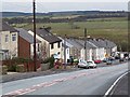
Cornsay Colliery village
Looking down the single steep street of terraced houses on the B6301.
Image: © Oliver Dixon
Taken: 15 Mar 2013
0.04 miles
2
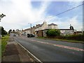
Looking up the bank at Cornsay Colliery
This former mining village to the west of Durham is built along a steep road. Probably there were houses both sides in the past.
Image: © Robert Graham
Taken: 15 Aug 2012
0.05 miles
3
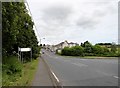
Cornsay Colliery from the south
Looking up the main street of this former mining village from the junction with the B6302. This is the road from Esh Winning, another former mining village.
Image: © Robert Graham
Taken: 6 Jul 2016
0.05 miles
5
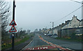
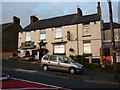
Cornsay Colliery
Commercial Street, B6301. Very low cloud.
Image: © wfmillar
Taken: 31 Mar 2014
0.08 miles
6
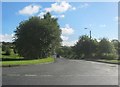
The B6302 to Esh Winning from the B6301 at Cornsay Colliery
Image: © Peter Robinson
Taken: 18 Sep 2013
0.11 miles
7
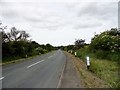
View west down the B6302
Looking towards the western end of this country lane from Esh Winning to its junction with the road through Cornsay Colliery.
Image: © Robert Graham
Taken: 6 Jul 2016
0.11 miles
8
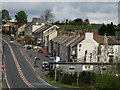
Cornsay Colliery
Cornsay Colliery is an old 'pit village' of County Durham.
Image: © Trevor Littlewood
Taken: 4 May 2010
0.12 miles
9
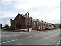
Cornsay Colliery, main street
Just about the only street too, in this former mining village. It runs down the bank from here.
Image: © Robert Graham
Taken: 15 Aug 2012
0.17 miles
10
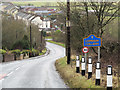
B6301 descending to Cornsay Colliery
Cornsay Colliery as the name implies is a village based upon coal mining. The B6301 is seen heading north, towards the village and descending to cross the Hedleyhope Burn. The blue and yellow road sign is typical of a style of signage introduced in County Durham some years ago.
Image: © Trevor Littlewood
Taken: 28 Dec 2012
0.19 miles